
Day 1: La Grande to a Camp on the Edge of the Road 30.3 Miles 5:20 Riding Time

We met at 1000 hours PDT in La Grande and were underway by 1100. The gravel route up the mountain was steep as expected. When we reached the first fork in the road, Scott assured us it it would get less steep; it didn't. We continued up to an old log cabin where the gravel ended and the climb became less. The surface was dirt with some large naturally occurring rocks that had recently been dry graded leaving a lot of dust to disguise the rocks. The county or USFS apparently decided the naturally occurring rocks weren't enough, so they hauled in 3" to 4" sharp rocks that were difficult to ride over and posed a danger to all bicycle tires making the riding almost as difficult as the climb had been. Eventually we rejoined the gravel road that we'd left 3/4's of the climb out of La Grande. We soon reached a ridge, and soon afterward Scott was bonking and out of water. A ridge is a bad place to look for water, and though we looked, we found none. When primitive camping on bike tour, I like to set up camp by about 1700 hours, but dry camping is a poor option- especially when we're out of water. By 1900 hours we did find a small pool of water with no place to camp. We thought there was a USFS site within 2 miles, so we rode on to a wide spot where people had occasionally camped. A cold spring was nearby where we could filter water, and with a 2' x 3' hole a cold bath could be had. Tents were rapidly thrown up, water filtered, and dinner cooked by dusk which happens about 2000 hours here in Pacific Time.We were all in our tents by nightfall.

Day 2: Side of the road camp to USFS North Fork Campground 27.9 miles 3:30 riding time
The next morning saw a quick breakfast of oatmeal and a variety of nuts and toppings and a quick cleanup.


The early morning ride was pleasant, but soon we reached a road surface like powder 3" to 4" deep. It was surprisingly easy to ride through, but it hid rocks and other hazards, was filthy, and was somewhat demoralizing.

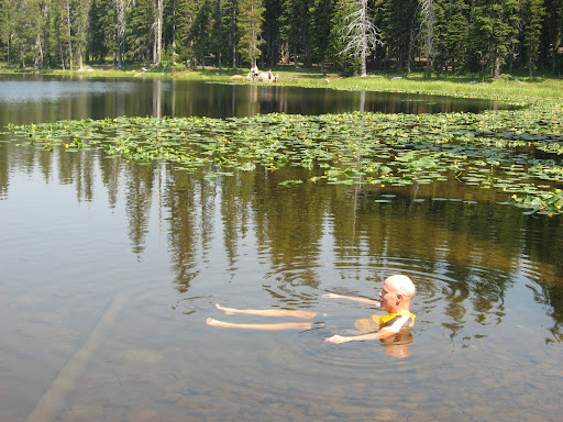
Anthony Lakes was the relief we had promised ourselves, but when we got almost there, we saw we had considerable descent to get there followed by a U turn and climbing back up to where we were. Lake Grande Ronde was just slightly offroute and roughly at our elevation, so we headed there for lunch, and to clean ourselves and our bikes a bit.

We were now on pavement for the ride down to the North Fork John Day USFS Camp where we arrived mid afternoon and enjoyed a another dip in the North Fork of the John Day. Doug was sent to some town 2 miles away according to Scott's GPS, but he came back without any treats.
Day 3 North Fork John Day Campground to Olive Lake 21.6 miles 2:41 riding time
We repeated those two uphill miles that Doug had done the previous day, verifying there was no store or town, then down about 7 miles miles to Granite, a village with a small convenience store that offered some Cisco meals they'd heat up. We all had a sausage/egg sandwich.

From Granite it was a mild climb up to the powerhouse where water in years past was piped from Olive Lake to the power house to generate power for the mines and this part of Oregon until 1967.


It was a steep climb on up to Olive Lake, a mostly man made lake built to store water for power generation. When the powerhouse was abandoned, the reservoir became more lake and less storage reservoir.

We arrived at the lake fairly early, so we did laundry, hiked around the lake, and Jen and Doug read. We met a friendly neighbor who provided us with fresh cherries from his orchard at Hood River, and provided us with a lesson in cherry growing and cherry types.
Day 4 Olive Lake to USFS Gold Dredge 38.2 miles 3:29 riding time
Day 4 was our easy day. It was down hill all the way to Dale, a rural convenience store, where we had hoped to eat in a restaurant. There was no restaurant, so we settled for a frozen breakfast burrito cooked in their micro-wave and eaten at their pic-nic table. Here we turned to go slightly uphill, and we picked up a tailwind! I was riding strong when we reached the fork in the road, up a water grade to a campground or up the mountainside for camping somewhere on top. We settled for the campground on the river and a short day.


Day 5 Gold Dredge Campground to North Fork John Day Campground 38.1 miles 4:44 riding time
The reason for the early stop yesterday was soon evident as we started up the mountain side- steep and long, yet never a killer hill.


Just after reaching the pavement on top we were surprised to meet a cross country cyclist- always a highlight for me. She was headed from Wisconsin to California via Portland. She headed on to Ukiah for the night, and we headed on to our 2nd night at the North Fork John Day CG. The road was mostly up and down with a steep downhill for the last 2 miles into camp where we set up camp exactly as we had 3 nights earlier. This was Scott's birthday, so he added an quick unloaded ride of unspecified miles to give him his age in miles.
We'd seen a couple of salmon pass by in the shallow river the first night, but this afternoon there were two males and a female in the shallow section of water at the campground. The large male was probably 3' long and a master of the shallow water, easily sailing through water only half as deep as his body in this section of water they obviously knew well. From watching documentaries I expected flailing and was impressed by the smooth movement these giant fish had through the shallow water. As we stood perfectly still, they'd come within a couple feet of us, and we spent some time studying them.
Day 6 North Fork John Day Campground to La Grande, OR 49.8 miles riding time 3:34
It was back up those steep 2 miles of pavement and then off onto a paved side road. Then over a hill, and down to the Grande Ronde River. We had planned on spending the night at a state park about 15 miles out of La Grande, but with the down hill and a mild tail wind, we decided to head back to La Grande a day early and celebrate with pizza.

It was another great ride- minus some of the issues of day 1 and 2, but it got us out of the smokey skies of Southern Idaho. Doug, Scott, and Jen had the meals well planned, and Scott's new water filter is nifty! All photos but the last are by Doug or Scott!
All Doug's Photos
Happy cycling for fun, fitness, and transportation,
Steve
Good Write up Steve. Jen uploaded her GPS onto some mapping software where it adjusted total elevation based on map overlays versus atmospheric barometric changes. The long and short of the story is the upload showed our elevation gain to be in excess of 22,000 feet.
ReplyDeleteCheers
Scott.