18 October 2015

A New Meadows Weekend with the Riddles

Mike and Nicki invited the club down to New Meadows to join them for three days of cycling.  Christy and I arrived Friday evening for an excellent supper and Sean and Carol joined us Saturday morning for the first ride of the weekend. The weather was perfect Friday and Saturday.  Sunday morning's rain was intimidating but relented just in time for the trails at Bear Basin near McCall.

Fat Tire Ride  Friday
34.1 miles, 3:41 riding time    2,674 elevation gain
Mike led the six of us south of town, east of town, and finally North of town on some excellent back roads (unpaved mostly).  There's a mountain just north and slightly west of New Meadows that Mike wanted us to climb.  Nicki and Carol decided to stay on the Valley floor while Mike, Christy, Sean, and I rode to the top on the gravel roads. There were a few hunters driving around but otherwise almost no traffic. The descent, like all descents, was fun with one big rise in the middle of the descent, then down off the mountain, across hwy 95, and back to New Meadows from the South.
Sean, Mike, and Christy near the top looking down toward New Meadows
Secesh Summit Ride Saturday  long version 
61.4 miles  4:21 Riding Time   2,343 ft elevation gain      
Our numbers grew to 10 for the main event- a road ride from McCall to Secesh Summit as Corrie, Linda, Steve, and Dave joined us. Just as everyone was ready to pull out of McCall's downtown parking lot, Christy noticed she didn't have the right shoes for this bike's pedals.  We could see a look of panic on her face as she thought about her options (basically two)  1) drive back to the Riddles, get the pedals, and then chase down the pack in her car or 2) skip the highlight ride of the weekend for which she'd driven down to New Meadows.  Then "someone" (many seem to claim the credit for this idea) suggested, "why not buy a cheap pair of pedals at Gravity Sports".  She nabbed Sean, and they were almost immediately in Gravity Sports.  About five minutes later Christy reappeared all smiles with her bike in tow only $5 poorer.  They installed and rented her a set of good pedals for $5 though she'd have to be back by 1700 hours to return the pedals.
Christy reappears with pedals that match her shoes- photo by Nicki
The route was through town and up the West side of the lake.  The pavement on the West side of the lake is in fair condition, but its flaws were disguised by dappled shade, so I hit several small potholes.  That problem seemed to end before we got to the North end of the lake though and the pavement was either smoother or I could see its flaws better as I hit no more pot holes.

Steve, Dave, Christy, Sean, Carol, Steve, Corrie, Linda, Nicki, and Mike at the North end of the Payette Lake
View of Upper Payette Lake as we passed it - photo by Nicki
Steve, Linda, and Christy at the top
Corrie at the top
Everyone made it to the goal of Secesh Summit riding strong and within a couple minutes of each other.  Here Dave, Christy, Sean, and I decided to ride on down to the end of the pavement - 2 miles short of Burgdorf. The pavement down the other side of Secesh is excellent allowing speed without potholes or other hazards.  I decided to have my apple here at the bottom and offered Sean a bite.  When I handed the apple to Sean, the basketball player, he must have thought he was blocking a basketball, and slapped it hard; up and over my head it flew to loud laughter from Christy and Dave who were watching as the apple flew over my head and down into the creek.
Sean retrieves Steve's apple
Sean pulled Christy and me into the headwind and up the hill where we regrouped with Dave at the top.  We sailed down the hill into McCall and met the rest of the group at a local brew pub.for snacks and brew.  Christy was early returning those rented pedals.

The main group on the way back down to McCall - photo by Nicki
Dave and Steve left us, but the rest of us returned to the Riddle's for dinner.
Dinner at the Riddle's - Nicki, Carol, Sean, Christy, Steve, Linda, and Corrie - photo by Mike
Sunday Bear Basin Mountain Bike ride 
8.6 miles  1:34 riding time
Carol had a call Saturday night letting her know she had company, so the Ellis' left early Sunday morning for Lewiston.  Rain which fell most of Saturday night kept falling intermittently, so Christy decided to wait until 0930 to decide whether to do the day's ride.  My legs felt tired from Saturday's ride which was speedier than my legs liked.  I think  sitting around Sunday morning with tired legs (in my case anyway) started producing a desire in me to do nothing, but Mike remained optimistic.  Christy headed back to Lewiston shortly after 0930, and Mike and I headed to McCall in a  real downpour - of a few minutes.  I had to turn my windshield wipers to high a couple times on the way to Bear Basin, but the rain had turned into a light drizzle by the time we got there.  The plan was to stay close to the vehicles, and quit if real rain returned.  The drizzle stopped while my windbreaker was just damp; soon it was dry, and then we were in shorts in T shirts despite the 51° temp. There was enough uphill to keep us warm, and the downhills were brief enough we didn't chill!  After only about 2 miles, the lactic acid seemed flushed from my legs, and my "do nothing" attitude was gone.  The ride was fun!  The trails were damp- not wet- with no puddles, no mud, and the trails were wide.  Christy, they weren't technical unless you call one spot where the pedals might hit a rock if not rotated correctly "technical".  You'd have had a great time there!  I'm sure my speed was a little slower than Mike's used to, but it was a great final act to the weekend! I wouldn't go here without a map or Mike to guide me, but I think with a lunch in my trunk rack, I could enjoy a day here!

Mike on the Bear Basin Loop


On behalf of everyone, thanks Mike and Nicki for a great weekend!

The rest of my photos

Happy Cycling for fun, fitness, and transportation!

Steve

22 September 2015

Return to Oregon's Old West Scenic Bikeway

18-21 Sep 2015

All the fun we'd had on this year's Grande Tour made Christy, Sean, Carol, Amy, Paul, and I want to do it again with a little tougher route before the cold weather hit.  Unfortunately, other commitments kept Amy and Paul away.  The weather was ideal unlike Doug's and my 2012 October experience in the cold on this route.  A pleasant rain ended early Friday morning before our start, so we began just as the clouds and smoke were gone.  We were more fortunate than the nearby Cycle Oregon's riders who were diverted off their planned route by the Richland, OR fire making them do some day rides out of Baker disappointing those we met on their ways home.

Day 1:  John Day to Bates State Park  31.4 miles  Riding time 3:16 Elevation Gain: 2,297 ft
We planned a half day cycling after our drives to John Day, but  our start was about an hour late at 1:00 PDT, but with the short day planned that created no real problems.  From the official start in John Day it's about 15 miles to Prairie City where begins the climb up the Dixie Pass, elevation 5,277. We stopped for photos about 1/3rd the way up at the oversized prairie schooner where I realized why my camera had been beeping at me; my memory card was still in my computer at home.  I'd have been more than willing to ride back to Prairie City for a new SD card, but would they have one?  John Day was a little too far away and would put me out of sync with the group, so I decided to rely on the cell phone photos of the others.
Sean, Carol, Christy, and Steve at the prairie schooner about 1/3 up the Dixie Pass- photo by Christy

The climb is mostly under 6% which I suppose makes it a little easier than the Old Lewiston or Old Winchester grades.  Christy and I took a break near the top where we waited for Sean and Carol and where we were surprised to see Carol show up 15 minutes later without Sean or panniers.  Sean was riding back to John Day to get the car.  Now, we dropped down to Austin Junction for 6 miles which were steep enough Carol was soon missing her panniers which contained her wind breaker. At Austin Junction, I realized, maybe Sean can get me a SD memory card in John Day, so Carol sent him a text msg.

Camping and showers are available at the Austin Inn, but the camping is superior at Bates State Park (but no showers), so Christy and I headed down the road the 1.5 miles to the park where we set up camp and met Wayne and Ken, two cyclists on the same route (though they'd started in Mitchell, OR a day earlier).  We didn't wait long for Carol and Sean to arrive - with my new 16GB SD card; thanks, Sean!  We had a good dinner at the Austin Inn.

A Ukiah Moment for Some
It was cool enough at bedtime that I left my sweat shirt on for sleeping, and cold enough I awoke in the night to curl up in a ball thinking "it isn't worth the trouble of putting my sweat pants on" as I fell back asleep.  I was protected by my Ukiah moment which happened during the1999 Cycle Oregon when I lay curled up in my sleeping bag wearing as many clothes as possible and stacking stuff on top of the sleeping bag as I lay wishing I could sleep or stop shivering while my TRC friends simply awoke, put on more clothes, and fell back asleep.  Immediately on completion of that Cycle Oregon I bought a warmer sleeping bag which has only been tested by the coldness of Bates- and it twice passed!  Christy and perhaps Ken had their Ukiah moment this night- lying in their sleeping bags shivering, wishing they had more clothes to put on and wishing they could fall asleep.  It was 24° when the park ranger arrived the next morningWith some questioning we learned Bates is in a bowl; the cold air flows down into it each evening off the surrounding mountains.  The ranger said it had been 50° as he drove across Dixie Pass on his way to work this morning and the temps fell to 24° as he descended to Bates.  So, if you plan on camping here anytime of the year, be prepared for cold nights!

Christy's frozen bike in Bates SP - photo by Christy

Day 2: Bates State Park to Long Creek, OR  53.7 miles 3:57 Riding Time  Elevation Gain:  1,824 ft
We hung around camp until the sun was up and the tents mostly dry.  We were enjoying Wayne & Ken and they us, so we decided to ride together. The best section of The Old West Scenic Bikeway  is Bates down to the junction with Hwy 395.
The combined group: Wayne, Carol, Sean, Ken, Steve, and Christy- photo by Christy


Between Christy and Sean is a color or geometric shape missing?


Ken, Sean, Christy, and Ken enjoying the downhill to Hwy 395

Christy, Sean, Wayne, and  Ken still enjoying the downhill

Wayne and Ken are from the Willamette Valley where they live in blissful ignorance of puncture weed (goat heads), but between Mitchell and Dayville they met with some puncture weed issues leaving Ken particularly paranoid about puncture weed.  That paranoia may have been the reason he skipped our lunch spot just before the junction of Hwy 395 where the climbing begins again, and where there was some puncture weed.

Sean and Christy begin the climb up 395, the photographer has the wrong angle, so Sean is mostly hidden by Christy

Christy nearing the top of the main climb up 395
We'd had some discussion on what the toughest day would be.  Experience told me it was day two, climbing up Hwy 395 and then through many ravines before reaching Long Creek, but the knowledge of feet climbed still made an impression for everyone else. After reaching Long Creek, I think we generally agreed day two was tougher.

Ken fixes a flat at the top of 395 while Wayne supervises and while Sean and Christy take a break in the nearby shade!
 Once reaching the top, it seems like it should be smooth sailing into Long Creek, but there seems to always be another ravine to cross before reaching town.  Crossing those ravines makes this the toughest day- in my opinion.  (They can't be called rollers; there's no way to get the momentum of the down to push you up the next hill).  Some thought they'd ridden enough on reaching Long Creek, and others wanted to ride on the 20 miles of "mostly downhill"  to Monument which is also a cleaner nicer town much lower in elevation where nights wouldn't be so cold, but we were all enjoying each other, and we all ended up spending the night in Long Creek.

Long Creek lies in the high desert just before the trees start.  It's not a particularly attractive town with many abandoned houses and dead overgrown grass everywhere, but the "convenience store", must be under new management since 2012.  Unlike 3 years ago, it has hours posted and enough groceries for a touring cyclist.  It also has a grill and tables where we had our post ride snacks and where we remained for at least an hour as we escaped the afternoon heat..
Our camp in Long Creek's RV Park
On the positive side the RV park's bathrooms were very clean, and they provide towels for each of us for $10 per tent. On the negative side, there is no shade (the trees you see in the above photo are in the adjoining trailer park and didn't cast their shadows our way) and no picnic tables. We escaped most of hottest part of the afternoon sitting in the convenience store. There was an old crusty bench which we used to hold our cooking stoves, and the camp had about 3 plastic chase lounges we used. Some found the night still a bit too cold, but having my post Ukiah sleeping bag, I was just fine!

Day 3:  Long Creek to Dayville 62.3 miles, 4:37 riding time   Elevation Gain: 2,677
If the morning was a bit cool, the ridge we had to cross before dropping into Monument gave everyone ample time to warm up. The ridge was a little more significant than I remembered, and I think everyone was glad we had stayed in Long Creek.
Sean, Wayne, Ken, and Christy nearing the top of the ridge out of Long Creek
Wayne on the ridge between Long Creek and Monument
Ken, Wayne, Sean, and Christy enjoy the downhill to Monument

Ken, Wayne, Christy, and Sean still enjoying the downhill outside of Monument
The downhill to Monument is great on a loaded touring bike with banked corners and open vistas, but not so steep that we were forced to brake more than a couple times briefly.  Ken had a 2nd breakfast in Monument at a small stand opened just for him.  The Monument grocery store is closed on Sundays. Ken had a sinus infection that hadn't told on his riding until about this point where he fell behind the group, and that's my belief as to why. He's a strong rider. We followed the John Day River and just before Kimberly where we met 3 credit card tourists from the suburbs of Portland while one was changing a flat. (They had driven to Dayville, rode to Prairie City, Long Creek and were almost back to their cars at the 1st nights motel that makes a tough day 2 but doable without gear to carry).  Since 2012 the Kimberly Store has been reopened.  We had lunch there and enjoyed their outside benches and talked to the credit card tourists who later joined us for a brief time on the ride to Dayville.  Kimberly is a convenience store only, but in a good location for lunch for those starting in Long Creek.  It also sells prepackaged sandwiches should future tourists need them.

Ken, Wayne, Steve, Christy, and Sean enjoy lunch outside the reopened and remodeled Kimberly Store - photo by Christy
 When we stopped at the John Day Fossil Beds National Monument, Ken caught us and rode on without us since he wasn't feeling good and probably didn't want to be dropped again!  We regrouped at Dayville's interesting general store. Afternoon temps were high enough to let us really enjoy their ice cream!

Sean, Steve, Wayne, and Christy leaving the Fossil Beds National Monument - photo by Christy


John Day Fossil Beds National Monument has the best bike rack for cycling tourists I've ever seen. The bottom cross bars keep the wheels from rolling and the spacing allows for loaded bikes!
Where to stay in Dayville, the Community Church (formerly the Presbyterian Church) or the RV park?  My memory of the church was pretty good, but I didn't want to dominate the group's decisions.  The church gave a feeling of connection to other cycle tourists (it's on AC's Trans Am route and has been providing a place for us to sleep since '76).  It lets you escape the tent for a night, and with the growing length of nights lets you stay up a little later with electric lights though we still went to bed about 8:00.  The church treats catering to cycle tourists as a ministry, and they made us all feel welcome  The woman who is the designated host came down, greeted us, showed us the facilities which included a shower and kitchen, and since I was there in 2012, they've added a washer (with detergent provided), a dryer, and a computer as well as internet for cycle tourists' use.

Carol and Sean preparing dinner in the church's kitchen- Christy in the background

Sitting around the church's tables enjoying the coolness after a post ride snack- Wayne, Christy, Sean, and Carol
Day 4 Dayville to John Day 31.8 miles  Riding time 2:35  Elevation gain: 997 ft
We were sorry to say farewell to Wayne & Ken that morning as they headed back to their car in Mitchell, but we were glad to have Carol rejoin the riding group.

Wayne and Ken say "goodbye"!  It was great touring with you two!
Carol and Sean depart the Dayville Community Church
We weren't 150 feet down the road when Christy suffered her first flat of the day (and of the trip)

Sean changes Christy's first flat of the day while Carol supervises- about 150 ft from the church
Carol, Sean, and Christy on the road from Dayville to John Day
Christy suffered her 2nd flat outside Mt. Vernon and now plans on bringing a patch kit in addition to two tubes on the cross country ride.

Hot link to:  All my photos

This is a great loop that we did in two half days and two full days which allowed for our motorized transport to and from John Day. 

25 August 2015

Ride Idaho 2015 Bicycling Thru the Smoke

Having such a great time on Grande Tour motivated me to find a supported tour that would take my last minute reservation, and I found Ride Idaho.  With some e-mailing, I found a group of Twin Rivers Cyclists not only recommended it, but was going, and I was pleased they let me join them!


Pre-ride McEuen Park to Higgins Point  15.6 miles    1:19 riding time
I arrived at Coeur d'Alene's McEuen's early, so set up my tent in McEuen Park, and then headed out to Higgins Point hoping this little warm up would make up for the 6 days I'd taken off the bike in the extreme heat we'd had. When I returned most of the group had arrived and set up their tents.  I moved my tent to be close to them.  We were on our own for dinner this first night which wasn't include in the price. We found coupons for a brew pub, but we found the wrong brew pub- food was good though.

Tent City in Coeur d'Alene's McEuen Park

Day 1:  Heyburn State Park to Kellogg, Idaho  54.6 miles  3:38 riding time
We were on the boat well before the scheduled 0600 departure, but actual departure was pretty close to 0630.  Breakfast was a little light- a sausage McMuffin type sandwich, small fruit cup, and yogurt, but adequate for day 1 of a ride at least for us.  Sitting next to the serving line we couldn't help notice many took more than one sausage mcmuffin, and late arrivers got none.   About 3 hours after taking off we arrived at Heyburn State Park where we disembarked to find our bikes that had been trucked down separately. Boating across CDA Lake sounds good, but at 0630, it's too cold to enjoy even in the heat of August.  We were fortunate to have had seats inside most of the ferry ride.
Linda, Corie, Jennifer, & Steve just before the boat docks at Heyburn State Park
Corrie rides over the bridge from Heyburn State Park - taken on the move
The boat ride caused everyone to leave together- in one big messy group.  The hurried passing began in the parking lot even on the heavily graveled access road (think 3 inch rocks- not gravel) before we reached the bike path or bridge which detracted from my first crossing of this bridge where I might have liked to have stopped for a couple of photos.  Most people had reached their desired location in the group by the time we reached Harrison when calls- or worse the lack of calls "on your left" began to end.  The route along Coeur d'Alene Lake is beautiful, but I got no photos in the crowd with all that passing, and we did our share of passing too.  We had lunch at the Cataldo Mission.

TRC and affiliates minus Tom- at Cataldo Mission lunch stop:  Linda, Corrie, Steve, Jennifer, and Laurence
We rode on to Kellogg where we set up our tents on school grounds.  Dinner was excellent- ribs, corn on the cob, a great salad with plenty available for seconds. Corrie and Linda can be seen dancing below..

Entertainment in Kellogg- Corrie and Linda in upper left - photo by Laurence


Day 2 taking the optional ride Kellogg to Wallace via Dobson Pass, up to Mullan, and back to Wallace  63.8 miles   5:15 riding time  

From the first day I'd first looked over Ride Idaho's website, I wasn't happy with the proposed 10 mile day, but they'd added an optional ride over Dobson Pass (the reverse direction of what we'd be doing on day 3).  With just a little talking I was able to convince Corrie (but no one else) to join me in climbing Dobson Pass which added about 40 miles to the day, and then we rode up to the end of the Trail of the Coeur d'Alene in Mullan. Kim, a rider from Sandpoint, overheard our discussions and asked to join us on this optional loop.  We were glad to have him, but the group broke into a speedy and not so speedy sub-groups, and Kim dropped us for the speedier riders.

Corrie and Steve at the top of Dobson Pass day 2
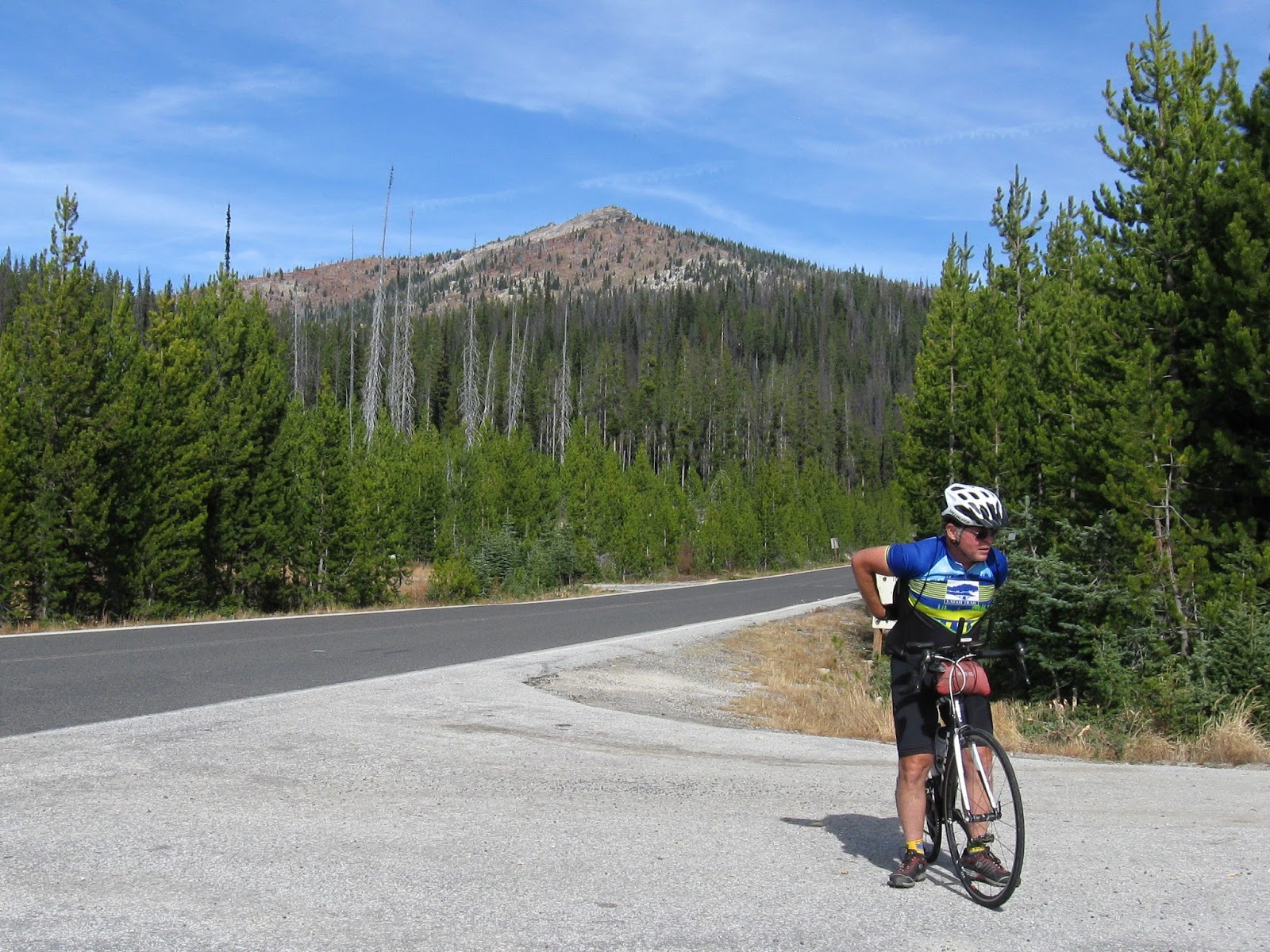
Day 3 Wallace, Idaho to Noxon, Montana  93.3 miles   7:07 riding time
The 5,680 ft of climbing scheduled for this day was the reason Corrie gave me just a little resistance about doing yesterday's options, and the reason no one else would join us.  However, Tom found the energy to add 7 miles giving himself a century today while Corrie and I added nothing!  I'm sure those who know us think it unusual that we'd stop with 93 miles; it shows we were tired!  Today's climbing was in the reverse direction of yesterday's optional loop.  Dobson is a fun pass from either direction; it has steep switchbacks to the top followed by an immediate drop on similar roads, and today's climb was followed by Thompson Pass, a modern sweeping road that's tougher to climb and brought to light my inadequate training for the ride.
TRC and affiliates at the top of Dobson Pass - day 3 -  Steve, Tom, Laurence, Jennifer, Corrie, and Linda
At the top of Thompson Pass- Steve, Tom, Corrie, Jennifer, Laurence, and Linda

The descent into Montana was on new pavement, less steep than the ascent, and with wide shoulders, so it was fun with little braking required despite our growing fatigue.  Then we turned onto state route 200, an unpleasant experience with too many vehicles compounded by angry red neck drivers. 
Linda, Steve, and Jennifer nearing Noxon in the thickening smoke that makes the Clark Fork behind us look like just more smoke
Jennifer pulled most of the way from lunch to Noxon setting a rapid pace in our simi-pace line.  Although Noxon has a high school, it has only one street and appears to have a population around 100.  It has a laundromat which Jennifer, the Rosetti's and I needed to use on day 3 - which would be our only laundry stop of the trip, and we were lucky enough to be its only patrons at the time. (I don't understand this- on Cycle Oregon laundry is a big deal, but we saw few signs that others did laundry on the trip- there were only 4 washers in the Noxon laundromat). The Noxon High School Juniors supposedly prepared and served our dinner, but most of the work appeared to be done by their mothers.  It was an excellent: salmon, baked potato, tasty mixed veggies, and dessert. 
the dinner line in Noxon
The smoke kept thickening, the sky reddened and darkened, and soon ash fell on us like a light dusting of winter snow.  At the evening route meeting we learned that fires would keep us from the published route to Troy, Montana and Bonner's Ferry, Idaho. There would be another meeting at 0900 the next morning, but the organizer wasn't going to call and ask that breakfast be delayed from its 0600 to 0700 or that the football team load the luggage later than the scheduled 0700.  (I suspect he was stressed by the route changes yet he remained reluctant to delegate this small chore to others).  So, we slept in just a little- up by 0545, and turned our luggage in shortly after 0615, and were in the breakfast line by 0630.

Day 4 Noxon, Montana to Sandpoint, Idaho 57.0 miles 3:55 riding time
Breakfast started about an hour late but was excellent.  The football team was not prompt at loading the luggage, so we were able to return our warm clothes to our luggage before the morning meeting and even return the tooth brushes to the luggage instead of carrying them on the bikes this day!  We learned we'd be diverting directly to Sandpoint via back roads that included about 10 miles of gravel roads.  Corrie reminded me of his vision problems, and I agreed to hold back to ride with him.  The gravel was thin, but the road was rough with some large sharp rocks sticking up in sections.  I was riding about 17 MPH in this gravel when Corrie, with vision problems, dropped me.  Soon I passed a rider changing a tire on the left side of the road, that, as I passed, thought was Tom rapidly changing his tire.  It turns out all 5 of the other TRC riders (or affiliates) rode by him without offering to help!  All I could think to do was apologize for not stopping to take his photo while changing his tire which should have been done in addition to an offer of assistance which likely wasn't needed.  He looked like he was making a video "how to change a flat in 5 minutes or less". Tom's extremely organized and thorough and seemed uncomfortable not having a spare tube with him the rest of the day.  Of course, those thoughts may have been aggravated by the knowledge of how helpful his group had been at his first flat!
Jennifer takes a break in the gravel section- just after Tom's flat

Considering highway 200 was an alternative, this route wasn't bad. Outside of the gravel sections it was excellent.  We had lunch in Clark Fork, BBQ hamburgers or chicken.  After we ate, the line got rather long but it probably would have gone better in the original location.  Flexibility is always required on organized rides in the west due to fires, and I've no complaints about how they handled the situation- except for not asking the coach to reschedule the luggage pickup and breakfast! The closer we got to Sandpoint, the less smoke we had to contend with.
The lunch line in Clark Fork, Idaho
The smoke gradually cleared as we neared Sandpoint which allowed us to use their city park on the beach as a 3 night campsite!  Linda, Jennifer, and I were soon swimming and playing on the log boom that separates the beach from the rest of the lake.


Day 5: 27.8 miles 2:57 riding time to Schweitzer and back
Since I was still tired from the dual crossing of Dobson pass and the single crossing of Thompson Pass I was happy to settle for the short optional ride up Schweitzer on this day.  Corrie and Linda took the day off the bike while the rest of us did the climb.

Steve, Tom, Jennifer, and Laurence on Schweitzer


Jennifer, Tom, Steve, and Laurence from the lodge

Tom, Laurence, Jennifer, and Steve from the end of the pavement

a photo of Jennifer at the top I like though the smoke makes it seem like an artificial background
While riding up to Schweitzer we again talked to Kim who then invited us to join him for an afternoon ride on his sailboat - a great opportunity and a great host!

Tom and Kim on the sailboat

Tom, Jennifer, Tom, Kim, Laurence, and Jon enjoy sailing

Jennifer at the helm
Thanks, Kim, for a great afternoon!

After the sailboat ride, Jennifer takes a lesson on this board

Tom has the next lesson

and the other Tom from Moscow also has a lesson
Day 6 Sandpoint to Bottle Bay, to Priest River, and return to Sandpoint
73.7 miles    5:45 riding time
The howling wind added to the noise of the nearby main line of the Northern Pacific Railroad.  Someone's rain fly was not tied down right and was especially loud.  Eventually it blew off eliminating the noise and that sleeper's supposed privacy as only mosquito netting remained to block the view in.  After she retrieved the rain fly, it was correctly replaced and was much quieter.  I won't name names, but if you have questions, ask Jennifer.
Rider services tent and others down and damaged in the night's wind storm


 It was still very windy the next morning.  Like everyone else in camp we weren't sure what we'd do as we prolonged breakfast not wanting to cancel riding while not wanting to ride in this wind.  Finally we decided to ride across the bridge, see how much we were buffeted by the wind, and maybe make the ride to Bottle Bay.  The wind on the bridge didn't buffeted us as much as we thought it would, so we headed to Bottle Bay which put us on the leeward side of the peninsula. When we reached the windward side, it was a cross wind which had died down some, so Corrie, Tom, and Jennifer decided to head to Priest River which gave us the long 73 mile option for the day.  With the promise from Corrie that he wouldn't drop me, I joined them.  More gravel.... but this section was more like hard pack which wasn't bad riding.

Tom, Jennifer, and Corrie on the road to Priest River
 Just before we reached Priest River the wind changed again (what problems for the fire fighters!), but became a Northwest wind which gave us a tailwind as we headed mostly East back to Sandpoint.  During dinner it switched again, to directly out of the North which brought the only clear deep blue skies we'd see on this week long ride.

Day 7 62.3 miles   4:18 riding time
The last day of a supported tour can be less than pleasant because I'm never happy to see a ride end combined the rush everyone gets in to get home, but no one rushed this day.  Winds were fairly calm but remained out of the north which gave us a mild tail wind at first; the wind died by lunch which was in Spirit Lake.  We kept a semi-pace line back to Coeur d'Alene where no finish line awaited us.  Laurence, Corrie, and Linda left while Tom, Jennifer, and I went to the beach for a final swim.

Linda, Tom, Jennifer, Corrie, Steve, and Laurence at the Coeur d'Alene finish
 
Here's the rest of the photos

 Ride Idaho compared to other supported rides
The per day cost of $126.43 including parking, is a little lower than most supported tours. The organization and structure of Ride Idaho is pretty loosy goosey.  On day one the volunteers knew nothing- they hadn't read the website and apparently had no orientation meeting.  They could not tell us how long we could park in the lot behind McEuen Park while unloading, if the ride times were really in Mountain Time as the web site had clearly proclaimed, or anything else.  It almost seemed a rider had to talk to Earl, the chief, in order to get the straight story on almost anything.  I didn't like the inflexible schedule that virtually required turning in luggage before breakfast- meaning we couldn't wear warm clothes to breakfast, come back, brush the teeth, and then turn in the luggage with the warm clothes and tooth brush- and that seems so easy to fix!  They made the right calls on rerouting us away from fires, but a phone call to the coach would have let us sleep in after the hardest riding day of the tour while awaiting that 0900 meeting!  Earl was doubtless taxed revising the route and talking to sheriff, county reps, Forest Service people and others, so he didn't want to borrow someone's land line for that call to the coach which should have been delegated to one of his capable staff.  Also, a thumbs down on the Wallace and Sandpoint bucks- in lieu of a provided meal.  Some places wouldn't let you use them for tips, some wouldn't let you combine them with use of a credit card (if you exceeded your meal allowance), and some refused to take them.

Mechanical Support seem excellent.  On day two, we discovered that Linda's 16 straight spoke racing wheel set was toast.  Much to my surprise the mechanics had a set of wheels to rent her, saving her vacation!

In summary the ride was good, the food good, the break and snacks adequate, and the volunteers helpful and always pleasant if not knowledgeable enough.  I'd do it again based on the route they choose. Of course, riding is always more fun with friends, so bring your riding buddies like the 5 others from Twin Riders Cyclists who made it even better!

Happy cycling for fun, fitness, and transportation!


Steve