I was delighted in late September when Will announced that he'd like to go to Moab for the mountain biking trip I'd been trying to get my Boise mountain biking friends to do since Doug and I went to Moab in 2010. He completed his PhD in late Sep, so I assumed we'd go sometime in Oct, but the month rolled by without any commitment on dates. I was surprised in mid November when he said we could go Thanksgiving week- after I thought the good cycling weather of Moab's fall was over.
 |
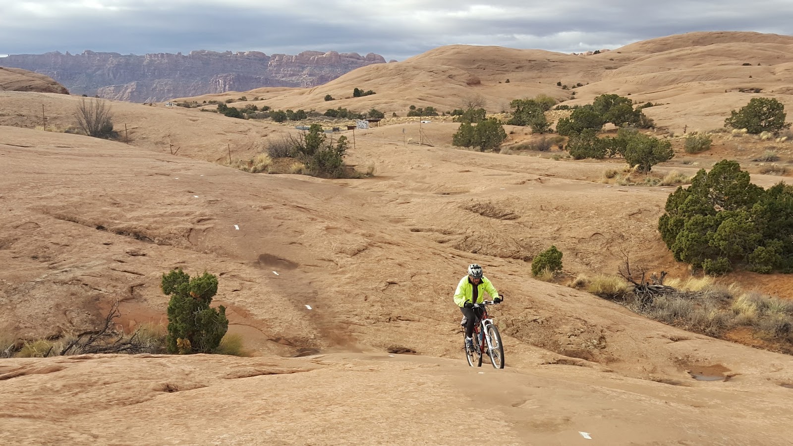
Steve and Will day 2 starting the descent of Porcupine Rim in short sleeves, but snow covers the nearby La Sal Mountains
|
Will hadn't been on his bicycle enough to mention this year, so on 21 Nov we did Corrals and the Freeway, a mountain bike ride with just under 2,000 ft of elevation gain in the Boise Foothills. Will seemed tired after this 32 mile ride. He's young and was determined to go to Moab and has been hiking and running, so we came down in early winter without much of a plan except to enjoy riding mountain bikes as the weather allowed. I thought I could rely on my 2010 blog of the trip Doug and I took to Moab, but at the last minute I found it was gone. I've since found and restored it, but we weren't able to use it for planning. When Will and I arrived in Moab, we searched in vain for a copy of Rider Mel's Mountain Bike Guide to Moab (6th edition of 2015. Before leaving we found it at Gearheads Outdoor store, but none of the bike shops had it this trip). An earlier out-of-date version had been very valuable to Doug and my 2010 trip though whatever version we had then was out-of date not mentioning many of the then newer trails, and there are further improvements since 2010.
 |
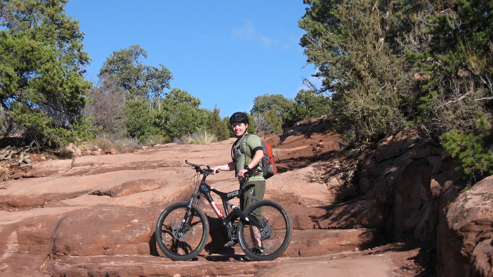
| Will on his only training ride nearing the high point of Corrals Trail |
20 November 2016
Moab to Arches National Park via Willow Springs Rd which becomes Willow Flats Rd
41.0 miles 5:07 riding time 2,569 ft elevation gain
With the short days of early winter we wanted to start every day at 0800, and Poison Spider Bicycles' website advertised opening at 0800 even on Sundays, so we were there at 0800 to see them busily loading up mountain bikers to shuttle them somewhere, but the shop was locked up tight. One of the customers told us Porcupine Rim wasn't rideable due to snow, so we changed our plan to ride into Arches National Park. Stringing together trails north of Moab gets one to Willow Flats Rd, and we were able to ride trails adjacent to that road shown on our map. The road has been closed to motorized vehicles since sometime after Doug and I rode it in 2010, and would now be impassable to most motorized vehicles, but a few miles inside the park the road is renamed Willow Flats Rd and is opened. It ends on the main highway through the park which Will and I rode down, out of the park, and caught the paved bike path back to Moab.
 |
| Steve on the trails leading to Willows Spring Rd |
 |
| Will on a canyon edge on Circle M trail |
 |
| Will cycling toward Arches National Park |
 |
| looking back- Willows Spring signs - photo by Will |
 |
| balanced rock where Willows Springs Rd meets the park's main highway |
 |
| Steve & Will in the park |
 |
| park view |
 |
| close to the exit of the park |
21 November 2016
Moab to Slick Rock, Practice Loop, and mid portion of Fins and Things
20.3 miles 3:55 riding time 2,234 ft elevation gain
Rain was forecast for today in Moab, but not predicted to begin until 1100 to 1200 hours, so we headed up to the nearby Slickrock and Practice Loop at 0800 trying to make the most of the morning when rain was most unexpected. The road up is surprisingly steep. When we arrived at Slickrock, Will immediately liked it. We diverted onto Practice Loop, and when it rejoined the main trail, we continued on. In just a short ways it became pretty steep, and for some reason Will wanted to turn around, so we left Slickrock and headed up to Fins and Things, a Jeep trail that may have drawn the Jeep owner in Will. When we arrived, I said, "That looks too sandy, and appears to follow a sandy draw which may not be fun". Will was sure I was wrong, so we headed down Fins and Things.
 |
| Will enjoying the beginning of Slickrock |
 |
| Steve climbing on Slickrock |
 |
| Will on Slickrock |
 |
| Will in the sandy Fins and Things Trail |
 |
| the sand continues |
 |
| the sand temporarily ends, but the clouds in the NW are building, so shortly after this shot we take an early exit of Fins & Things and head to Moab's Pizza Hut |
Since
the forecast of rain was sure, we had packed no lunch thinking we'd eat out
in town after the rains started between 1100 and 1200 hours. Despite the clearly building clouds neither of us was ready to head back to town, but the clouds in the above photo forced us to decide to return to town whether we were ready or not. As soon as we sat down at Pizza Hut, a hard rain arrived - about 1400 hours. The only riding in the rain we did was from Pizza Hut to the motel in hard rain. Rain continued the rest of the afternoon and on and off all night.
22 Nov 2016
Porcupine Ridge
32.5 miles, 6:46 riding time, 3,504 elevation gain
The rain had stopped by 0600 this morning when we got up. Porcupine Ridge would be the highlight of the trip, so we were off to a big breakfast. Poison Spider's website had advertised high end full suspension bike for $55 per day, but they didn't open until 0900 hours and when we went by last afternoon, they didn't offer to allow us to pick them up the night before. The actual price was also $90, and we knew if we had any problems we'd not be back by the 1700, when they closed so Will stuck to his full suspension downhill racing bike with problems in its full suspension fork, and I was on my hardtail After a big breakfast we rode off just after 0800 a few minutes later than planned.
 |
| Will caught how narrow this short paved section is, but none of the shots caught how steep this section is |
 |
| Shuttles drop people off here, but we did climb from Moab to this point - Will at the beginning of Porcupine Ridge Trail |
 |
| Steve beginning Porcupine Ridge Trail |
 |
| Will - making some progress up |
 |
| sometimes the climb is a lot steeper than any pavement |
 |
| A flat- I assume from a sharp rock. Slime worked so I just pumped it up and rode on - photo by Will |
 |
| occasionally the trail looks like and even rides like red pavement |
 |
| Steve on the smooth section that rides almost like pavement |
 |
| At the top Merlyn joined us for lunch- unfortunately this photo of our lunch companion is by far the best taken at the top |
 |
| Will enjoys lunch with a view |
 |
| out of focus Steve looking over the world! |
 |
Steve with the freshly snow covered La Sal Mountains in the background
|
 |
| Will loses his chain from the master link which turned out to be a fortunate occurrence |
We took a long lunch break and took plenty of photos - most of which are slightly out of focus.
Will's cell phone photos had been sub-par on this trip, so I almost forced my 2nd camera on him. He agreed on the performance issue, but thought he figured out the problem and fixed it which made him lose interest in the camera as his confidence in the cell phone returned. When he lost his chain, only from the master link, about 100 ft from the top, I went to grab the camera I'd lent him to take his picture, but the camera wasn't in his pack. It was a short run back to the lunch spot, where he'd left it. I picked it up and shot the above photo.
 |
| lunch consumed, chain reinstalled, camera retrieved, and back on the trail enjoying the views |
 |
| shadows soon grew long, and yes the trail is rough |
 |
| some of the drops were too big to ride |
 |
| The colors turned redder as the sun set |
About the time we took the above photo we realized we wouldn't get back in daylight. We sped up a bit, but darkness began to fall before we reached the critical side canyon. We rode as long as possible without lights, and at twilight dug them out. I brought both my NightRider lights to Moab but after overloading my trunk bag yesterday and ruining its zipper, I brought only one light on today's ride. It ran about 3 minutes and shut itself off. Apparently, in my crowded pack it got turned on running out its battery. "Huston, we have a problem", I called out to Will. I asked for his 2nd light, but he'd forgotten it! With one rider in the dark, we were forced to push our bikes instead of riding. Soon, we reached the critical side canyon where a scramble with bikes is required to cross. That crossing was in the dark and slow. Will went down and then shone his light back for me to see to crawl over the rocks with my bike! As we climbed up out of the side canyon, Will remembered he had a tiny 2 lumen light (approximately) attached to his backpack and lent it to me. It was about the size of two dimes held together which seems like too little light, but in the dark of the moon following his 50 lumen light, its two lumens allowed me to see most of the rocks in the trail as I pushed. I wouldn't plan on getting to this trail head after dark, but if that befalls you, I can't think of anyone more calm and rational than Will to come in after nightfall along the canyon wall descending to the Colorado River.
 |
| Steve negotiating the side canyon in the daylight of 2010 - photo by Doug. Will and I were apparently lost in the challenge of negotiating this in the dark as we failed to take any photos- a flash would likely have worked |
When the trail finally ended at the road along the Colorado River, we were relieved to get on what we thought was 1/2 mile of bike path. It turns out the route back to town now has a paved bike path except for about 0.5 miles. Will had Gorilla tape to attach my borrowed mini-light, so I would no longer have to hold it between two fingers, and I freeloaded off Will's light for the ride back into town. We had a big dinner and went to bed by 2200 hours.
23 Nov 2016
Circle O and Bar M Trails North of Moab
6.7 miles, 1:36 riding time, 548 elevation gain
Our three days were over, but we wanted to get in a little ride on the way home, so we stopped a few miles north of town. We wanted to ride between 1 and 2 hours before the nearly 10 hour drive back to Boise, and I've liked the portions of Bar M that I've ridden, but Will thought that would be a little short and devised a plan to ride Circle O (too rough in my opinion after riding it) and parts of Bar M.
 |
| Will on Circle O - follow the yellow line across rough rocks |
 |
| Steve on the rough Circle O - Will's cell phone is taking good photos again |
 |
| Will back on the more agreeable surface of Bar M Trail |
I'm ready to return to Moab with friends, so let me know if you're interested, and yes a full suspension bike would be best for Porcupine Ridge and several other trails! We returned in 2018.
Will and I stayed at the Roadway Inn for less than $50 a night for the two of us. Avocado bathroom fixtures are dated, but it was clean, not run down, cheap, in downtown (a real benefit for cyclists compared to just out of town camping), but it had limited WIFI. Much to Will's surprise, we did see many camping in Nov, but even I admit I prefer a motel to camping in mid Nov when there are only about 10 hours of daylight with hard rain one afternoon and night..
Happy cycling for fun, fitness, and transportation!
Steve