
Day 46 19 July 2016
5 Miles W of Conover, Wisconsin to Crystal Falls, Michigan
68.8 miles 6:41 riding time 1,273 elevation gain
As we got ready to leave in two groups, Sean found his I-Pad - in his panniers. I'm not making fun of Sean, most tourists have lost stuff in their panniers (me included). Dan decided he had more to do to get ready for RAGBRAI, so he'd drive Sean to the airport to get the helmet, and they'd ride out to Phelps. With the extra riding Sean would be doing today, Carol took her panniers back for the first day since crossing the Rockies. We said our good-byes to Dan on the outskirts of Phelps where he'd left Sean, and we were back on the road.
 |
| We crossed into Michigan shortly after leaving Dan and Barb's. Steve, Christy, Carol, and Sean |
 |
| Alpha Michigan's old school impressed me with its wealthly East look |
 |
| Alpha's Village Hall also has a New England look- but from an earlier era |
Day 47 20 July 2016
Crystal Falls, Michigan to Esconada, Michigan
77.1 miles 6:37 riding time 1,286 elevation gain
Sean had Carol's panniers back on his bike as we left Crystal Falls. About 10 miles out of Crystal Falls we ran into road construction. The flagman sent us through and told us to stay to the right on this one lane highway and to watch the construction trucks. After riding for maybe a mile, we had oncoming traffic. Two big com'l trucks were headed our way with their driver's side wheels well into the grass at the side of the road. Sean, Carol, and Christy started riding farther into the grass, but with two large trucks headed at me with half their wheels off every part of the road bed, I came to a stop well out of their way. Although we had different reactions to that incident, we were all glad to get off that section and on to new black top for the next section of the ride.
We took our first "power nap" for the trip about 7 miles short of Esconada.
 |
| Carol, Sean, and Christy taking a power nap outside of Esconada, Michigan |
Day 48 20 July 2016
Esconada, Michigan to Indian Lake State Park, Michigan
55.0 miles 4:35 riding time 1,286 ft elevation gain
Clouds had built overnight, and we had a slow morning as we broke camp and moved to another area with a pic-nic table for breakfast prep which made the the sink for clean up even farther away. Clouds were dark as we started out about 0830, and it didn't get lighter when we stopped on the edge of town for groceries. The route took us to a rather heavily travelled state highway for a few miles, and it kept getting darker. None of us turned on our lights, but we should have. All the cars had turned on theirs. The group was dropping me as we reached an exit. I wasn't sure they'd taken it, but I was sure I wanted out of the building storm, so I took it and headed to McDonalds. Just as I hit their parking lot, the rain and hail started to fall leaving me pretty wet by the time I was inside where it turned out my fellow travelers already were. Severe Thunderstorm warnings were in effect until 11:00, so I dug out my computer thinking I'd catch up with the blog, but the T storm soon took out McDonalds WIFI as well as their ability to take debit and credit cards, so no, the time wouldn't really be redeemed. We talked to other travelers who didn't even want to drive their cars through the storm. After about 1 1/2 hours, the WIFI seemed to come back on. The storm lifted, and we were back on the road about 2 hours after pulling into McDonalds.
This was a short day- had we not missed the turn off to the state park, it would have been under 50 miles and was still only four and 1/2 hours of riding time. We enjoyed a group swim in Indian Lake but took no photos.
Day 49 21 July 2016
Indian Lake State Park, Michigan to Epoufette, Michigan
67.9 miles 5:07 riding time 966 ft elevation gain
Sean, the morning meat cook, knocked the fry pan off the stove this morning, spoiling half the sausages. Feeling bad, Sean, the carnivore, initially refused to eat any of the remaining meat, but we convinced him those things happen (much like the raccoons taking the bread from my panniers), so we left camp on a smaller than usual meat allotment.
Ever since the laundry day in Whitefish, MT, I've tried to keep my laundry of cycling clothes separate (I don't like my delicate cycling clothes washed with velcro, open zippers, etc. and the others don't mind those things). Realizing she couldn't get past today, Christy hand washed some clothes last night, but that realization didn't seem to hit Carol until sometime on the road this morning, so plans for the day were altered to stop mid day to wash clothes at Michihistrigan. Luckily they had WIFI though that camp ground offered no swimming or hiking! This nearly led to a very early end of the day, but after the washing we found a strong tailwind had developed, so we got in a full day riding despite stopping in the middle of the day to wash clothes.
We saw the first cycle tourist in several days today headed West, but US 2 was so busy we just waved as did he. Cycle tourists almost always stop and talk for a while, and we all normally enjoy these meetings.
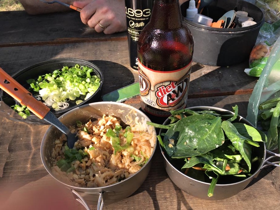
We found a primitive campground for pretty cheap, and ate out at a "Friday Fish Fry" which were advertised all over the Upper Peninsula.
 |
| All You Can Eat White Fish Fry |
 |
| view of Lake Michigan from the restaurant |
Day 50 23 July 2016
Epoufette, Michigan to Millcreek Campground 4 miles off route near Mackinow City, Michigan
41.6 miles 3:36 riding time 692 ft elevation gain
Just a little more than a half day's mileage and riding time today. We rode busy US 2, sometimes 2 lanes with wide shoulders and sometimes 4 lanes with narrow shoulders to St. Ignace where we caught the more expensive $26 "ferry" to Mackinac Island leaving behind the Upper Peninsula which seems like the first significant mark that the trip is winding down- something I don't like to think about. Mackinac Island is a tourist trap with no cars allowed- something which attracts cyclists. The business district near the ferry was way too crowded for me- and I think all share that opinion. We got a reasonably priced hamburger and rode the 8 mile bike path around the beautiful island with its great beaches. I could have checked out the one or two other streets in town but wouldn't have spent much more time here though it is worth seeing. A few hours after arriving we caught the ferry on to Mackinaw City on the mainland. We seemed to be in a hurry to get to the campground. We went for another swim after setting up camp. Lake Michigan is surprisingly warm and clean. We ordered pizza delivered to the gate of the campground, and Sean cycled off to get it. Unfortunately, on the way back to camp the bungee cord came undone, caught a spoke and broke that spoke in the middle (not at the elbow where I thought all spokes broke). With a little thought, we decided that if Carol's panniers were returned to her bike, Sean's bike might make it to Petoskey with its 3 bike shops. Sean loaded his heavy rear panniers on his front racks, and moved his torpedo bag to the rear to balance his bike. (No photo - sorry Sean seemed to avoid the camera with this set up, but I allowed that)
 |
| Mackinaw Bay Bridge - photo by Christy |
Day 51 24 July 2016
Millcreek Campground 4 miles off route near Mackinow City, Michigan to Petoskey, Michigan
58.5 miles 5:38 riding time 1,604 ft elevation gain
It's rolling hills here in Northern Michigan just below the UP. It's beautiful with thick trees. Soon we hit the "Tunnel of Trees Highway" as it's officially known. The thick canopy and dark clouds made for poor photos though.
 |
| Sean, Carol, and Christy entering the Tunnel of Trees |
Day 52 25 July 2016
Layover Day Petoskey, Michigan
11.7 miles 1:53 riding time 614 ft elevation gain
It rained last night with some pretty strong winds, but our tents are good and kept everyone dry. A neighbor had lent us his large tarp, so the bikes and pic-nic table were mostly under cover- except that the tarp mostly blew off Christy and my bikes as it continued to protect the pic-nic table and Sean and Carol's bikes.
 |
| Sean and Carol take seriously the rest in "rest day" - photo by Christy |
Today was laundry day- Christy and I even washed our sleeping bags which needed it after 52 days on the trail and a few uses before this trip! The group prefers lots of idle time on layover days while I prefer to see things and keep moving. I skipped yoga on this layover day with the excuse it was too windy to hear Tony this morning! This afternoon I have Christy out exploring downtown in this lively, clean, toursity town.
Day 53 26 July 2016
Petoskey, Michigan to Whitewater Township Park outside of Elk Rapids, Michigan
67.6 miles 6:09 riding time 1,841 ft elevation gain
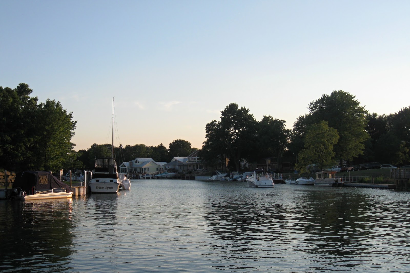
Sean declared this was one of the best riding days of the trip. It was a good one- great scenery along the lake, a diversion into farm country, and then a back quiet road followed by swimming again in Lake Michigan. When we passed through Traverse City, we stopped at Einstein Cycles where master mechanic Dan got Carol's shifters reseated and working properly ending a shifting nuisance for her that had plagued her since departure and through several other bike shops which weren't able to fix the problem.
 |
| Carol, Sean, and Christy at a boat dock we inadvertently saw |
 |
| farm scene outside Petoskey, Michigan |
 |
| leader of the A/C supported Westbound Northern Tier Group |
 |
| Stepheno Westbound lightly loaded tourist |
Day 54 27 July 2016
Whitewater Township Park outside of Elk Rapids, Michigan USFS Campground outside Glen Arbor, Michigan
63.6 miles 6:00 riding time 1,371 ft elevation gain
Beautiful camping and swimming at the Whitewater Township Park with good camp neighbors. Most of the morning was spent on beautiful quiet trails, but the trail through the town of Suttons Bay was round about and every intersection across streets was rough. Outside of Suttons Bay, we got on Highway 204 also designated as Bikeway 35. It's easily the worst road of the trip with shoulders between 1 and 2 foot wide that are rotted- dangerous broken pavement that extends to about 1 ft inside the fog line on busy roads! Even if these shoulders weren't rotten, I'd rather ride Hwy 12 above Arrow Bridge for you TRC members. Just before Glen Arbor, we met two West bound cyclists who recommended we ride the "closed" bike path. What relief to get off that section of road. When we got to the USFS campground outside of Glen Arbor, they told us it was full and that they maintain no "Hiker Biker" section, but their nearby "group camp" had space. That sounded good and not too different from a "hiker biker" camp site, but it was easily the worst campground of the trip. Desert like weeds, unmowed grass, yellow water out of the faucet, and someone had cleaned shell fish at the water supply leaving others to look at that gross mess every time they went for water. I forced myself under the faucet for a quick shower. The others settled for "baby wipes" for their daily clean up.
 |
| USFS Campground outside Glen Arbor, Michigan to Manisfee, Michigan |
 |
| Carol's successful scheme to keep the raccoons out of our food in Purgatory Campground |
USFS Campground outside Glen Arbor, Michigan to Manisfee, Michigan
63.6 miles 6:00 riding time 2,434 ft elevation gain
We were awakened by drizzle at dawn. It was hardly enough to dampen the outside of our tents, but being unhappy with the camping (except for the friendly neighbors), we had planned cold breakfast sandwiches to speed our escape from this purgatory. Most of the campers here were waiting to get into the main USFS camp and our friendly neighbor drove back to the main USFS camp at 0200 to get his family a spot in the real campground! There was a bikepath leading right out of the camp. It was somewhat steep in places but beautiful.
Due to our late breakfast we stopped for snacks in Empire, where the path also ended, and Sean decided it was time for a haircut. Since he's so fast, he told us to ride ahead of him. We stopped at a clear river to watch people lining up to go canoeing. Great suggestion for future riders' layover days! We had lunch at a scenic overlook, ice cream in Arcadia, and rode on to Manisfee where Christy and I sneaked away to the library before we went grocery shopping and then out to the campground to meet the Ellis'.
Day 56 29 July 2016
Manisfee, Michigan to Carrieville State Park Michigan 3 to 5 miles outside of Luther, Michigan
63.3 miles 5:36 riding time 1,352 ft elevation gain
Carrieville State Park was nice compared to the USFS group site in Purgatory. It did lack showers, so we asked a passing teenaged boy if he swam anywhere nearby. He gave us directions to his swimming hole where we all cooled off. Green grass and good clear water from a hand pump made it far superior to Purgatory.
 |
| Well marked bike path - on the way to Purgatory |
 |
| Sean and Christy ready for a swim in lieu of a shower |
 |
| white boy Sean and Christy swimming at Carrieville State Park |
 |
| camp may look a little like Purgatory near Glen Arbor, but this one has grass, a swimming hole, and good water - Carrieville State Park camp near Luther, Michigan |
We rode a few miles into town for dinner where loud music- local singers' remakes of popular songs played at too loud volume dominated most of the dinner until staff changed bringing more agreeable music at a lower volume.
Day 57 30 July 2016
Carrieville State Park Michigan to Clare, Michigan
70.6 miles 5:56 riding time 1,955 ft elevation gain
We were cycling out of Clare when one of the city park's board members met us and gave us a sales pitch to stay at the city park which had showers- something we hadn't been sure of. He even drove slowly back to the park leading us there, and later he brought some home-made cookies by, and neighbors brought by hot turnovers and ice cream for a 2nd dessert. We've certainly been well treated everywhere.
Day 57 31 July 2016
Clare, Michigan to Bay City State Park, Bay 3 miles NW of Bay City, Michigan
63.3 miles 5:36 riding time 233 ft elevation gain
It rained between 0.1" and 0.25" last night from the water in the Ellis' bowls left out on the table which served as our water gauge. Everyone's tents work well to keep us dry once the tents are set up. Rain kept us in our tents a bit longer than usual and dampened the cooks' desire to cook (as well as the dish washer's desire to wash). We had breakfast in a nice downtown hotel and hit the Pere Marquette Trail. It was laundry day again for Carol who is operating on 3 sets of cycling clothes instead of four, and she was wanting a motel. Eventually Christy and I decided we'd stick to camping at Bay City State Park and likely take our layover day there. The trail was great, but it ended in the town of Midland. We had lunch at a pic-nic table on some school grounds, and as we were departing we saw how dark the clouds had become East of town- just where we were headed. We crossed an overpass taking us out of town, and the drizzle turned to rain. We popped into the local animal shelter to find our own shelter.
 |
| finding shelter from the rain at the Midland Pound under the overhangs |
 |
| Christy's clothes drying rack didn't work that well today |
 |
| Chicken Pad Thai dinner - good |
Day 58 1 August 2016
Layover day Bay City State Park outside of Bay City, Michigan
5.4 miles 0:47 riding time 30 ft elevation gain
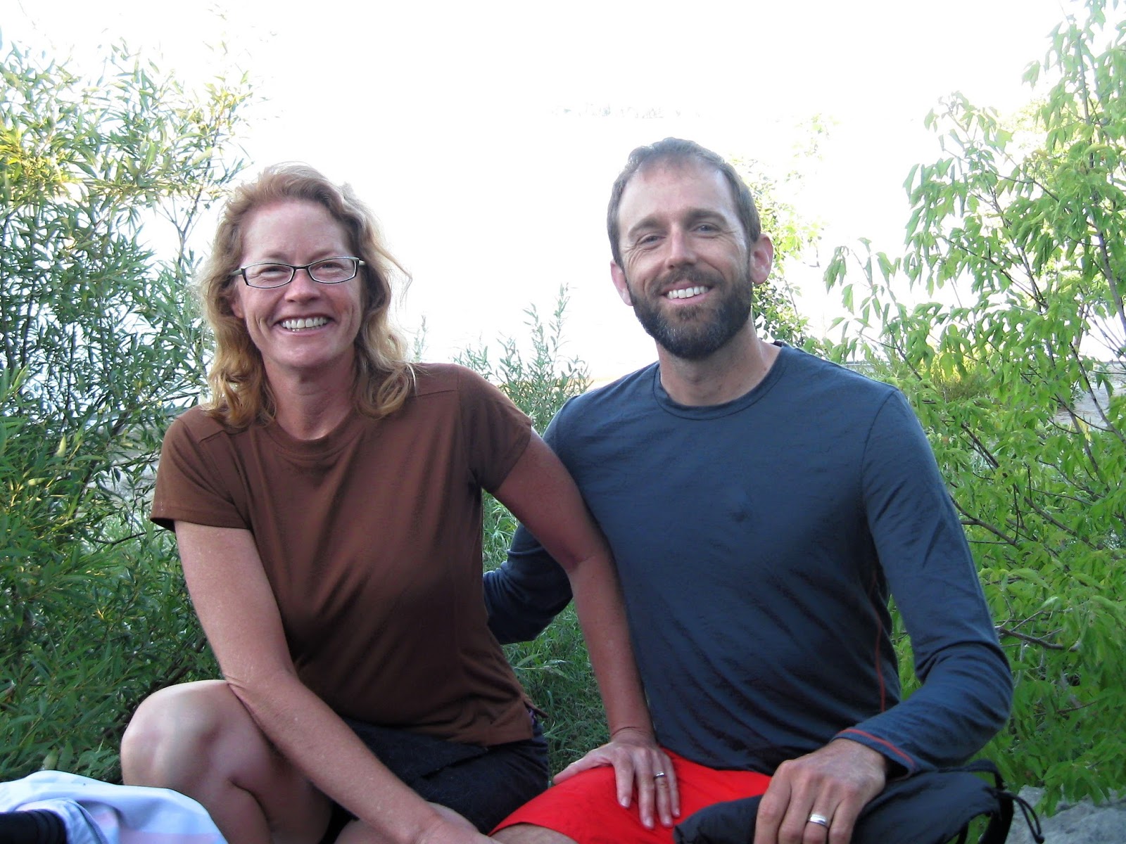
We slept in a bit today. I got up and did Yoga solo. Christy cooked the oatmeal, but there was no breakfast meat, so this is a rare day without meat for breakfast. Carol and Sean took all the dirty clothes into a laundromat while Christy and I catch up on the blogs, but complications arose as the laundromat they'd Googled is now closed. They returned to camp about 1330 with 18 miles logged for the day- not as restful as they had planned, but with clean clothes. An E-coli alert kept us from swimming in Lake Heron. However, the camp was beautiful, and Carol declared it one of her favorite layover days. We had John and Shari as neighbors who made it a better day! They ran their beautiful huskies on their bikes (his a trike), took us on a pizza run, went shopping for some groceries, and provided good campground conversations.
 |
| John with Sierra and Shari with Luna |
Day 60 2 August 2016
Bay City State Park, Bay 3 miles NW of Bay City, Michigan to Sutters RV Park near North Branch, Michigan
58.8 miles 5:01 riding time 531 ft elevation gain
Sean and Carol had the complicated route on trails and back roads into downtown figured out after their yesterday's laundry excursion, so we followed them the first 8 miles or so. Then we were on bike paths and back roads to the RV park near North Branch.
 |
| farm scene between Bay City and North Branch, Michigan |
Day 61 3 August 2016
Sutters RV Park near North Branch, Michigan to St. Clair, Michigan
70.0 miles 5:51 riding time 527 ft elevation gain
Michigan offers lots of great bike paths and some highly trafficked county roads. We were on both today. S Range Rd into St. Clair is the latter. We couldn't find camping, so we're in a hotel tonight. Looks like some problems finding camping may be coming our way as we enter Canada tomorrow though.
 |
| Murphy's Inn St. Clair, Michigan (our 2nd hotel of the trip) |
 |
| waterway behind our hotel- maybe 100 yards from Lake Heron |
Into Canada
Day 62 4 August 2016
St. Clair, Michigan to Clearville Park, Alberta
70.0 miles 5:51 riding time 433 ft elevation gain
Not far from our hotel was the ferry that took us into Canada. We enjoyed talking to about 15 riders from Cycle America- a $7,000 supported tour across the continent.
 |
| some of the Cycle America riders on the ferry to Canada |
 |
| Sean, Carol, Steve and Christy on the ferry to Canada |
 |
| entering Canada: Carol, Sean, Christy, and Steve |
 |
| enjoying a swim in Lake Erie: Carol, Sean, and Christy |
Canadian drivers, we've found, are more courteous than American drivers. Rarely do they pass without going completely into the oncoming lane, and they don't pull back in until the pass is completed which is refreshing.
Our experience with Canadian campgrounds says they're expensive and full of rules - so many tents per site and so many adults per tent. I was wondering how Canadians can be so compliant with endless rules. As we rode into our first campground we were greeted with a loud hearty yell of "Welcome to Canada!!" Our friendly neighbour was breaking many rules- a huge tent in addition to his camp trailer, and way more than two adults in his site, so here's a photo of his site. He did introduce himself as the mayor of the campground and told us not to worry about the rules! So much for compliant Canadians! We never saw the government workers who supposedly enforce those rules.
 |
| leaving the campground of the non compliant but proud Canadian |
Day 63 5 August 2016
Clearville Park, Alberta to Burwell, Ontario
71.4 miles 6:16 riding time 925 ft elevation gain
Nothing dried last night because of the high humidity, and we all slept without any covers. The temps got worse during the day, but we have to admit this the is first really hot day since the unseasonal heat we had from Anacortes to Republic, Washington. We rarely leave the route, but the gals wanted to see "Uncle Tom's Cabin", so we went about two miles off route. When we got there the entrance fee was $7.00, so we all decided to skip it.
Canadian camps seem to be expensive as well as full of rules. This evening we were put in what seems more like a gravel parking lot than a campsite in beautiful Ontario.
 |
| grass between Canadian fields and the road is generally mowed - giving the farms a garden-like appearance |
 |
| more Ontario fields |
 |
| our expensive gravel lot campsite at Port Burwell - photo by Christy |
Day 64 6 August 2016
Burwell, Ontario to Warmshowers host outside of Selkirk, Alberta
71.5 miles 6:15 riding time 1,368 ft elevation gain
The heat and high humidity of yesterday seemed to break during the night, and I even slipped part of my sleeping bag over myself during the night. Roads today were mostly flat with smooth pavement and little traffic. It's amazing how little developed the north side of Lake Erie is- but there are plenty of what appear to be moderately priced houses facing the lake though the usual signs of sprawl - strip malls and convenience stores seem to be lacking. We spent the night in one of those houses with our Warmshowers hosts: Mark and Lisa who host a lot of cyclists on their lake front property.
 |
| Mark and Lisa our Warmshowers hosts - photo by Christy |
 |
| our tents in Mark and Lisa's front yard Judd and Victoria took a small spot directly over the lake |
 |
| the view we enjoyed from Mark and Lisa's front yard |
 |
| Victoria and Judd |
Day 65 7 August 2016
Warmshowers host outside of Selkirk, Ontario to Ridgeville, Ontario
46.0 miles 3:54 riding time 433 ft elevation gain
We had a short day today as the gals- in charge of the daily changes in the plan- thought this would line us up for tomorrow's Niagara Falls. No campgrounds were available in this area, so we're in the 3rd motel of the trip which is not nearly as nice as the old Muphy's Inn we just stayed in. The route was flat on quiet roads today. We had lunch in Colburne where we met and talked to several cyclists from Buffalo, NY. We had a bike path on into Ridgeville.
Day 66 8 August 2016
Ridgeville, Ontario to Middleport, New York
72.3 miles 6:51 riding time 837 ft elevation gain
Dropped
The group seemed eager to "get the miles in" this morning. I prefer to enjoy the miles rather than "get them in" and with Sean in the lead they took off a little faster than I like. We were nearing Niagara Falls and had decided to get on the bike path when it would appear. Shortly after this decision they dropped me. The bike path was soon on the left meandering about, so I decided to stay on the road knowing it would be the faster way to catch my speeding companions, and the road offered a better view. When the bike path crossed the road with a huge sign and painted cross walk, I was sure they'd not miss it and would take the bike path as planned. It crossed onto a small island with views of both sides of the river. When I met other cyclists, they hadn't seen my companions, so I decided that in their hurry they had missed both parts of the bike path. I continued on to the visitor's centre where I expected they'd show up.
 |
| view of Lake Erie |
 |
| first view of the falls |
 |
| back with my companions with American Falls in the background |
 |
| the bridge we'll take back to the USA |
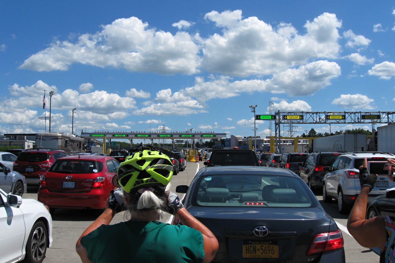 |
| standing in the traffic snarl- where we likely didn't belong- to cross back into the USA |
Continued on Northern Tier - New York - Phase V
Happy cycling for fun, fitness, and transportation!
Steve