26 October 2021

Moab Mountain Biking 2021

We arrived in Moab with enough time for what has become our standard Moab shakedown cruise- down to the Colorado River bicycle bridge for photos plus ride up some steep hill, but as we headed out dark clouds threatened, and we found the wet ground showed signs of recent washouts.

 Steve and Will at the welcome to Moab sign a couple days later - photo by Willl

 l
Steve with the bicycle bridge to Moab in the background - photo by Will

Day 0- Thu 30 Sep 2021
Lazy Lizard Hostel to a hill above Moab
4.0 miles, riding time 0:34, and 282' elevation gain
 
We rode toward the bicycle bridge over the Colorado River, but those dark clouds were growing more threatening, so we turned up a steep street and found an even steeper walking path which we unsuccessfully tried to ride. We had lights and were prepared to ride in the dark to accomplish our shakedown cruise, but we weren't mentally prepared for a cold drizzle, so we headed back to the Lazy Lizard Hostel as daylight turned to dusk and as light drizzle started. Light rain continued most of the night which combined with the dampness from earlier rains nearly eliminated Moab's characteristic red dust and loose dry sand for this trip.

Steve above Moab at sunset on day 0

Day 1 - Fri 1 Oct 2021
Sand Flats Rd, Eagle's Eye, and Falcon Flow Trails 
33.0 miles, 5:30 riding time, 4,104' elevation gain
 
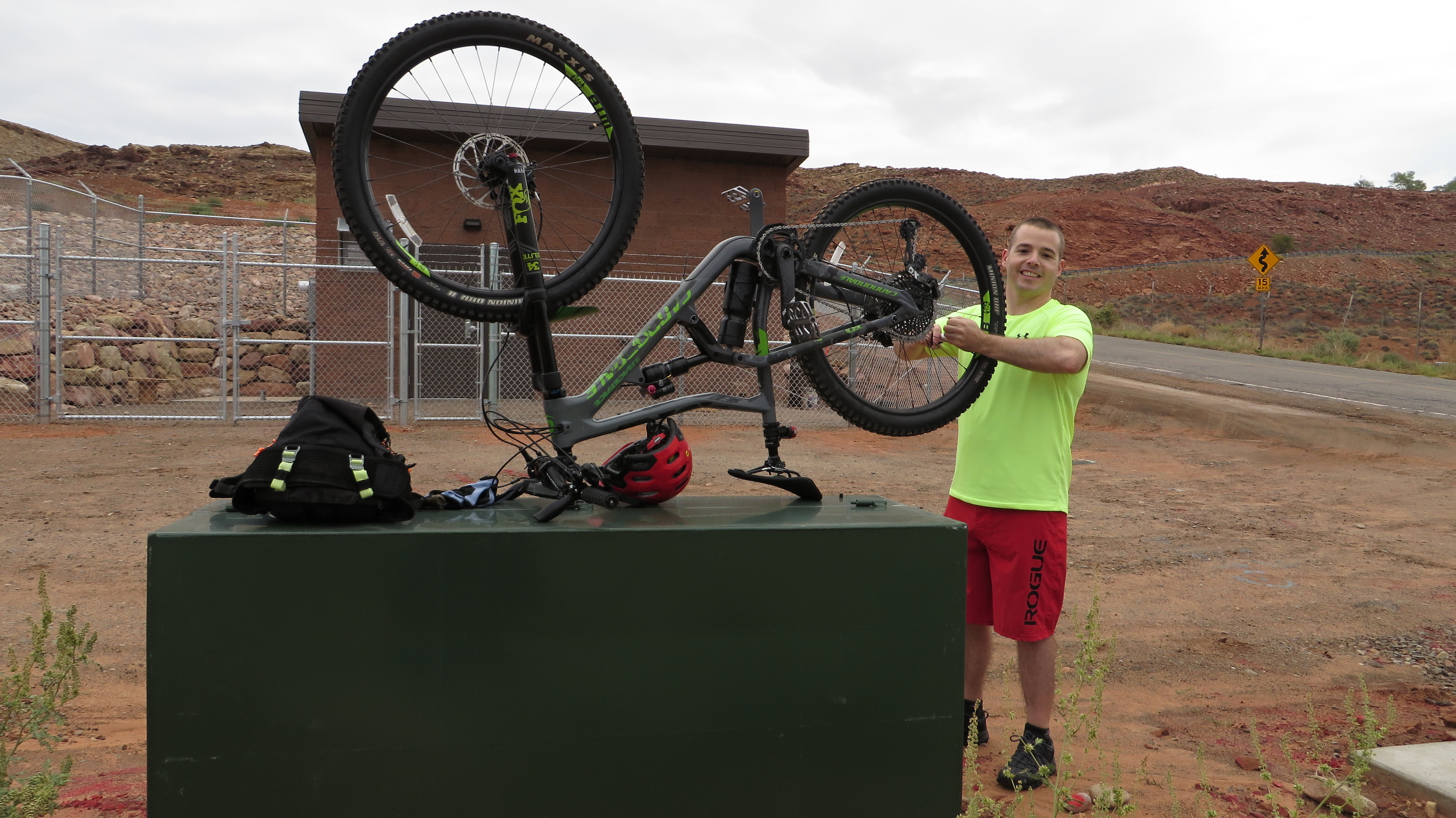
Will had done nearly all the planning for the trip with my vetoing only a couple of trails as too technical, so it was Will who chose to ride up the long and steep Sands Road.

Will adjusting his derailer on the outskirts of town-  proving last evening's shakedown cruise was too short.


Sand road offers some great scenery.

Will enjoying slick rock at the side of Sand Road

 
Steve on some slick rock


I was a bit disappointed when we got to the Porcupine Rim trail and learned that we wouldn't  take it to the top, but that would have been a day too long. However, we took pictures at the trail head where we might have gone and where we've gone before.
 

Near the top of Sand Road a couple of strangers catching us as we took a break

Will has gumption when he tires, but even his gumption was beginning to wear down as we neared the top. A longer morning break with a snack helped revive him followed shortly at the top by lunch and a very brief nap which seemed to restore his energy.

Still the climbing continues as Will nears the top.

 We added a few hundred yards to enjoy these views at our lunch break which was on the LPS route just before it turns into the well known Porcupine Rim Trail. LPS seemed very busy as many speeding cyclists passed us as we lunched. Perhaps it's become that busy or perchance a shuttle dropped them off just in time to pass us on our lunch break.
 
view from our lunch spot on the Porcupine Rim Trail which was just off route

Another view from our lunch spot - photo by Will

 
Will seemed entirely revived by lunch and the knowledge that downhill awaited us on Eagle Eye and Falcon Flow Trails, and after lunch it was he who was often waiting for me as riding  got a bit technical at times requiring that I push over a few obstacles that he easily rode over.

Steve on Eagle's Eye Trail - photo by Will


Will on one of the many "drops"

Clouds slowly lifted throughout the day. I think "Falcon Flow" isn't flowy enough to warrant that name, but it it did have flowy sections and was within my abilities.

Day 2 - Sat 2 Oct 2021
Mustang, Whirlwind, upper 7 Up, Coney Island, Big Lonely, Chisholm, & Rodeo Trails
25.5 miles, 5:33 riding time, 1,879' elevation gain

We drove out to the Mustang Trailhead on hwy 313. I'd requested a repeat of the 7 Up Trail, so Will put together this combination of trails that outside of 7 Up were generally as technical as I could handle - stretching my abilities but not over stretching them. I gained confidence throughout the day and found myself trusting both the trails' design and my abilities, but the continual drops seemed to tire me by the end of the day while they seemed to energize Will. 

Steve disappearing on the Mustang Trail - photo by Will


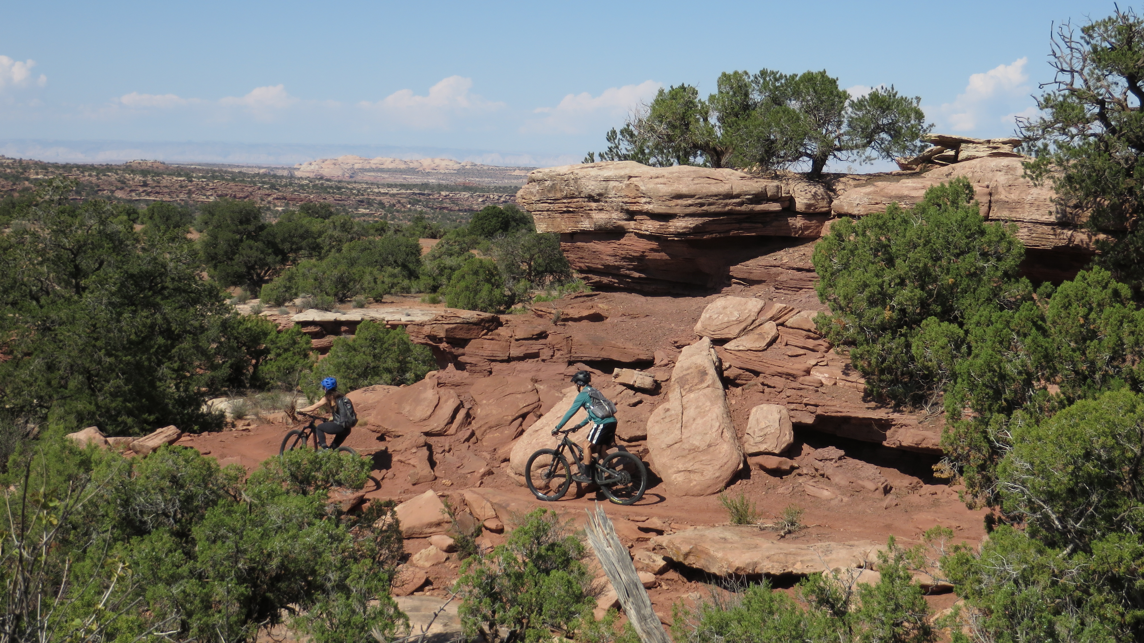
A couple of strangers on a scenic section of trail

Will had downloaded the route into our Garmins, but neither we nor Garmin knew part of the route was one way, and the Garmins didn't adjust to the required reversal of the planned course. Although neither the elevation gain nor the distance show this as a difficult day, by afternoon break I was ready for the ride to end. I'm blaming this on my technical skills being stretched - but not exceeded- by the trails that followed 7 Up. As I tired it seemed like we did a circle within a circle, but the recorded route shows a small circle at the bottom of the main circle.

Day 3 - Sun 3 Oct 2021
Monitor & Merrimack from town
42.4 miles, 5:38 riding time, 2,828' elevation gain

Any tiredness I felt from the prior day was gone, and I particularly enjoyed the slick rock and views on this trail. Today was the only day we rode the roughly 10 miles of paved path to the trails north of town, and it was as we exited town today that the two introductory photos in this blog were taken.

Steve crossing the Colorado River on the bicycle bridge outside of Moab

The paved bicycle trail took us about 10 miles before we turned off onto a steep jeep road that led to the actual Monitor and Merrimack Trail.

Steve as the jeep road becomes steep - photo by Will

Will at the top of the first steep section of jeep road which in this photo doesn't look as steep or rough as it was.

Will starting up another steep section of jeep road

Will after most of the climbing

Steve after most of the climbing - photo by Will

Steve on the slick rock of Monitor and Merrimack - photo by Will

Will enjoying Monitor and Merrimack's slick rock

Steve on more slick rock of the Monitor and Merrimack - photo by Will

We took a lot of photos and really enjoyed this slick rock. Will now says we must return to Monitor and Merrimack every year, a thought I can agree with. The sick rock eventually leads into a sandy draw, and although the sand was still a little damp, we had to push through sections of it. After the earlier rains we found water in the draw.

Will finishing the sandy draw
 
Then it was back down the jeep trails and on to the "out of town" Chevron Station for ice cream before bicycling roughly 10 miles of paved path down to Moab. It was a great day with some steep climbing, great views, great slick rock, just a bit of loose sand in the final draw, and a Klondike Bar!

Day 4 - Mon 4 Oct 2021
lower 7 Up, Whirlwind, Mustang, Get-Away, Arthur's Corner, and Gemini Bridges
30.0 miles, 5:34 riding time, 2,585' elevation gain

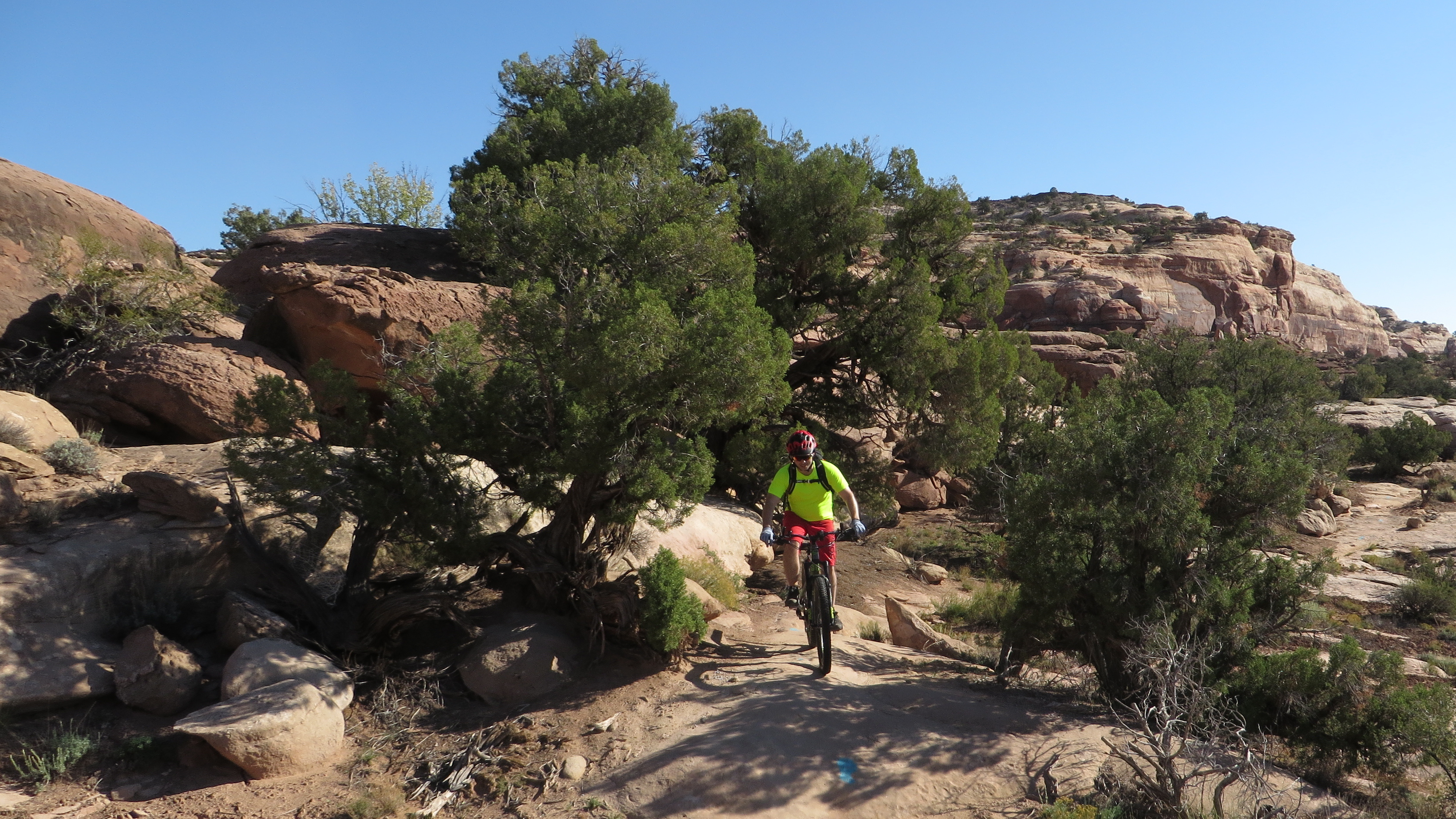
We parked the car at the junction of hwy 191 and 313, and rode up hwy 313 to the unmarked 7 Up Trail head which would easily be missed if not loaded into our Garmin routes. 7 Up and the others offer some great desert scenery without being too technical.

Will on the first stage of 7 Up

There's slick rock here and there too.

Will in a sandy section

Steve on a section of slick rock- photo by Will

Scenery is always changing
Will in the pinons

Steve riding a drop - photo by Will

Will rounding a corner

Arthur's Corner was short but slightly more technical than the other trails, and then we were on Gemini Bridges Road (jeep road) with some deep sand followed by a steep climb and a great descent back to the car.

View from the top of Gemini Bridges Rd. We'll descend now to the valley below - photo by Will

Day 5 - Tue 5 Oct 2021
Klondike Bluffs: Inside Passage, Jurassic, Agate West, Homer, Baby Steps Loop, Inside Passage
22.2 miles, 4:16 riding time, 2,077' elevation gain
 
We drove to the Klondike southern parking lot, but I strongly recommend driving to the northern lot which won't subject your car to so much buffeting and may even be a shorter drive without so much rough dirt roads paralleling the highway. It rained again last night and the forecast called for more rain this afternoon which had Will wanting to finish early.
 
Our route had us on almost flowy trails dodging large rocks, but without many rocks in the trail. Then we turned and climbed, and both of us pushed over some of the steep rocky sections. First thing this morning my camera's memory card was suddenly "full", so there are no morning photos from me. At lunch I deleted a few old photos which allowed a few afternoon photos.

Much of the trail wound its way through rocks without being rocky- photo by Will

There's also a lot of slick rock that looks like a super-highway. Here Will is on a section of it.

Steve on some slick rock - photo by Will

Will on Baby Ladder

Steve and Will on Baby Ladder

Ladders are apparently things too steep to ride and require either pushing or carrying a bike. We could push up Baby Ladder. We found a group of friendly ATVer's at the bottom who took the photo of us both. After Baby Ladder, the slick rock freeway opens up again.

Will on the long wide section of slick rock after Baby's Ladder

Will between two rocks on the return either on Jurassic or Inside Passage

Because of the possibility of rain, I couldn't talk Will into extending the ride on any trails, but he did allow me to ride up the road to get my day's accumulated elevation gain over 2,000 feet!

Steve on the road getting his last feet of elevation gain to total over 2,000'


Day 6 - Wed 6 Oct 2021
Bar M
5.8 miles, 1:08 riding time, 597' elevation gain

Will had a later flight from SLC, so as we drove north we had an extra hour or two for a short ride, and we both like some of the trails at Bar M. I'd taken a 2nd camera with me, so after yesterday's full memory card, I switched cameras. When I went to snap the first photo, its battery was dead, so I took no photos on this last partial day of riding. We usually switch bikes for a couple hours, and today was that day, so I was on Will's new Canondale Trigger - a better bike than mine, but I spent too much time adjusting to its small differences like its Scram shifters and handlebar controls of the shocks. I enjoyed Will's new bike, but I'd rather ride it in less technical conditions like at Klondike Bluffs while I adjust to the Trigger's slightly different controls and different feel. Will seems to instantly make those adjustments. Will has a fancy soft sided carrying case for his bicycle, and we spent close to an hour packing it up for its flight home.


Will on Steve's Trek Superfly 8

 Logistics
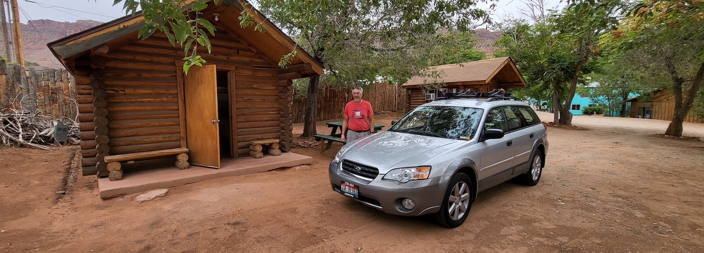
2021's inflation has hit the motel industry nearly doubling prices since we were here in 2019, so we returned to the Lazy Lizard Hostel where we had a cabin with two bunk beds and a desk for just over $50 a night. Management and the guests in the main hostel seemed friendlier than in 2018 when we last stayed here. The bathroom was 100 feet away, but was immaculately clean. I'm comfortable returning here. Eating out was another story. The Moab Brewery, a favorite for years, has deteriorated to typical bar food- gone are the great salads, homemade breads, and extensive menu. Denny's, usually a good breakfast option, was operating only as a drive-in - call ahead for pick-up and on greatly reduced hours. One night we bought a rotisseried chicken and sides from the local grocery store for $20 and ate it from our cabin's pic-nic table,  and that was my favorite dinner this year while there.
 
Inside our cabin at the Lazy Lizard - photo by Will

 
Outside our cabin at the Lazy Lizard - photo by Will

 
Food issues aside this was another great vacation. Thanks, Will, for another set of great memories!
 
Happy bicycling for fun, fitness, and transportation!


Steve
 

 Our preferred maps

2019 Moab Trip 

2018 Moab trip

2016 Moab trip

2010 Moab trip


02 July 2021

Bicycling 800 Miles to my 50th Class Reunion

Although I'd had no interest in attending my earlier class reunions, I found myself wanting to go to the big 50th reunion on my bicycle. Then the virus struck and the chances of having it went down, and to make things worse we had planned to have it in Washington State with its severe lockdown. That resulted in a cancellation, and the desire to bicycle to this reunion began to grow in me

As things began opening up in the spring of 2021, it looked like the reunion might be just a year late, so I picked up my training plan, and once that was going well, I decided this would be the year, and I'd go up through Oregon partly on the Trans Am route though that would be tougher than a ride through Idaho. When I charted this out on Google Maps it showed a one day elevation gain of 9,144 ft between Halfway and Enterprise, Oregon which I didn't think I could handle. Friends encouraged me to go for it, and I made contingent plans to camp in the forest but would have found those otherwise enticing campgrounds dry!

Day 1: Saturday 12 June 2021
Boise, Idaho to Vale, Oregon
90.5 miles, 8:38 riding time, 1,906' elevation gain 
 
Zig-zagging with the section lines through SW Idaho out to Adrian, Oregon is a route I do annually, but it's been a few years since I went all the way to Vale- a route I've modified on occasion to give me two back-to-back centuries. I thought my memory would take me there, but it took me to the first ride I ever did to Vale, and that route washed out years ago. It is now 3 or 4 miles of gravel. It did connect to the paved route I intended, so I was soon back on pavement. The final leg of the day took me over Keeney Pass which was hot and dry
 
The Snake River at Marsing

Oregon pride not evident in this "welcome" sign


Sunset Market like so many small town and rural stores is permanently closed eliminating a stop I used to enjoy
 
Vale's getting close with this monument at the top of Keeney Pass
 
I arrived in Vale hot and tired but was greeted with enthusiastic shouts by Hassan Alshawi, a Saudi student studying in Kansas and taking the summer off to bicycle tour across the country. He's doing the Trans Am but taking that "shortcut" across southern Idaho's desert. He's doing daily You Tubes, but between the language issue and my lack of familiarity with You Tube, I'm not creating a hotlink at this point. I wanted a real dinner and Hassan had settled for a convenience store "dinner" so we separated. The restaurant I've always liked in Vale has reduced its hours to 1000-1900. As I was finishing dinner their door was locked promptly at 7:00 p.m. In these days of enhanced unemployment benefits, they can't find employees for a 2nd shift! Luckily for me Hassan showed up later at the campgrounds and we enjoyed touring conversation for the evening and next morning.

Hassan Alshawi is a fun loving enthusiastic young cyclist I enjoyed camping with the first night


Day 2: Sunday 13 June 2021
Vale, Oregon to Unity, Oregon
68.5 miles, 7:22 riding time, 3,192' elevation gain

I didn't like leaving my enthusiastic and fun companion, but the summer heat was telling me to get on the road early, so after a convenience store breakfast with Hassan (nothing else was opened), we said our good-byes and I was off to Unity. There was a new cafe in Willowcreek which is close to Vale, but the old stores in Brogan and Jamieson were gone. Fortunately, Brogan still has a city park with trees and a water fountain! I thought I could find similar shade and water in Ironside as the temps grew, but neither was available. I really wanted a break after Brogan Hill, but no shade and no water were to be found!

It's a hot climb
 
There's some descending before Ironside where I remember on my first ride across Oregon in the late 70's a nice little store and post office. Neither survive and I could find no shade nor even a welcoming water spigot. By the time I reached El Dorado Pass I had one water bottle left which I was rationing.

Trees are appearing in the distance by the time I reach the top of Eldorado but still no shade, and I'm thirsty!

Fortunately, it was only a few miles from Eldorado Pass to Unity where Hassan had recommend I stay at the convenience store/campgrounds/filling station. Although there was plenty of elevation gain today at 3,192', with the early start and the 7:22 riding time, it felt like a short day compared to day 1. I enjoyed water, shade, ice cream, and their WIFI.  Use of the washing machine and even detergent were included in my $10 camping fee.
 
My home for the night, a $10 camp site in Unity with pic-nic table and WIFI
 
 
Day 3: Monday 14 June 2021
Unity, Oregon to Baker, Oregon
52.0 miles, 5:25 riding time, 2,238' elevation gain

Hassan's recommendation was good and I enjoyed my stay here, but although the convenience store severed a real breakfast, it didn't open until 0800 Pacific Time, so I fixed a quick breakfast and was on the road before 0700 Pacific Time. Four or five miles down the road was Unity Lake with a $8 hiker/biker site where I had planned to stay, so I rode through the park to check it out. Without WIFI or a store of any kind, I was glad I'd stayed in town though a cool swim would have been a real treat yesterday afternoon.

Unity Lake from the camping area 
The campsite not chosen; a good alternative for those carrying dinner and breakfast supplies
The broad valley briefly turns into this canyon which is dammed creating Unity Lake and providing irrigation below.

The canyon soon opens up to another broad irrigated valley growing mostly hay and pasture

After following the irrigated valley for a few miles the route turns to go over a recently burnt  mountain which provided most of today's climbing.
 
Looking down at the burnt mountain I'm crossing

Both sides of the mountain are burnt, but the Baker side is so ugly I didn't photograph it!

I was fortunate to meet and camp with Hassan on night one and the owners of the grounds in Unity
Judith host and touring cyclist

were very pleasant, but I don't like too much alone time when riding solo, so I had sought out a "Warmshowers" host in Baker. It was Judith who lives on the edge of downtown. When I was
four doors down from her place, two pedestrians, John and Kristina, stopped me and introduced themselves. They were two tourists staying at a motel a block from Judith's. They also recommended I check out the new bike hostel on the edge of downtown Baker. It had a couple cyclists staying there, but I had a reservation with Judith. She has a great set up for a Warmshower's host - a basement with a bedroom and bath. She didn't want to go to dinner with us, so I walked over to John and Kristina's motel, and we went out for Mexican food.  They started in Missoula and had planned to ride to the coast, but Kristina was going to quit- catching a bus here in Baker while John rides on.

 
Day 4: Tuesday 15 June 2021
Baker, Oregon to Halfway, Oregon
68.2 miles, 5:25 riding time, 2,238' elevation gain

I eventually found the Oregon Trail Motel and Restaurant that Judith had recommended, but it was closed. Oregon isn't fully opened after the virus shutdown and the generous unemployment benefits that pay more than work! As I left the Oregon Trail's parking lot, I was sure I saw a touring cyclist. I shouted, but got no response and decided the panniers were light enough it might just be a bicycle commuter. As I crossed under the freeway I found an opened cafe and had breakfast. I checked out the Baker City Lewis-Clark Interpretive Center but found it opens only later in the morning. I saw fresh bicycle tracks there and every other time I pulled off the highway. 

I was planning a simple lunch of PB&J and fruit in Richland, but as I looking for a store, I spotted that bike I'd seen this morning. Pam was inside a cafe enjoying a salad and tater tots. We talked until her husband joined us having had his lunch in the other cafe. I wanted to ride with them, so I skipped lunch and bought an orange at the town's grocery store.The hill between Richland and Halfway contained most of the day's elevation gain, and I noticed they took it slow resting at certain goals. I told myself that's the only way I'll make it up tomorrow's 9,144' elevation gain!
Pam and Jim on the climb nearing Halfway, Oregon

Jim and Pam at dinner


We rode into Halfway where they had a motel reservation. My Warmshower hosts,
Tom & Linda, excellent Warmshowers hosts


Tom and Linda, had to drive to Joseph that day, so wouldn't be home, but told me to set up my tent and shower, so I did that and headed back to town to have dinner with Pam and Jim. As I headed back to town I met Tom and Linda on the road. Service at the "Main Place" in Halfway was horrible. 90 minutes after ordering we still hadn't received our salads, and while I was enjoying my conversation, I wanted to get back to my Warmshowers hosts. Pam then ran down a waitress, and cold food was soon delivered without the salads! I enjoyed Jim & Pam so much that I was sorry to leave them, but eager to get back to my hosts. They were wonderful hosts! I apologized for my late arrival, and we enjoyed conversation until dark fell. They'd ridden several Cycle Oregons that I had ridden, and we had much to talk about. They were very encouraging about the 9,144' of elevation gain Google predicted for me tomorrow, and seemed sure that estimate was wrong though they got the same info when they Googled it. They'd ridden it and didn't believe it was that difficult. They served a great breakfast the next morning, and I was off, sad to leave such excellent hosts. I told them it felt like leaving relatives which was true.

Day 5: Wednesday 16 June 2021
Halfway, Oregon to Enterprise, Oregon
84.2 miles, 10:19 riding time, 6,549' elevation gain 
 
I was hoping to meet Jim and Pam on the way out of town, but I had no such luck. If they had "service" like we had last night, they might not get out of town until noon, and their climb up to Council, Idaho is also significant. The morning was cool and pleasant still following the Trans Am until I turned off on a paved forest service road to Joseph.
Following the Trans Am route toward Hell's Canyon

I followed this stream up most of the way to the first summit
This was the "big day" the day I'd feared and which had almost intimidated me so that I nearly didn't ride to the reunion. The climb started as soon as I left the Trans Am. I was soon in the cooler forest. Tom and Linda had told me there would be three summits to cross, and climbing the first would be the most significant. It was. At the top of the first summit I met four supported riders from Portland and talked for 15 minutes or more. There were supposed to be two riders behind them whom I never saw, but within two minutes of leaving them I met another group of four self-supported riders! It was a group that had asked to stay at my place under the Warmshowers program that I had to turn down because I'd be on this tour. They were young, enthusiastic, and very flexible in their planning. They took a photo of my plan as they realized riding the Weiser River Trail on road bikes likely wasn't feasible. Both of these groups reported that the upcoming campgrounds were "dry", but they had stayed there last night and boiled river water to drink. Meeting these two groups at the first pass raised my spirits I realized I had 3,268' of my 9,144' completed, but that's only about 36% of the scheduled climb!
 
 
Progress seems slow, but it's a beautiful ride

 
The four supported Portland riders doing much of my route in reverse

 
The four self-supported riders from Portland I met moments later who had requested to camp in my yard

The downhill on the blacktop was quick and fast. I checked out a couple of the campgrounds along the Imnaha River and verified they were dry as I enjoyed my lunch of PB&J sandwich and Fig Newtons. I had two water bottles left and two passes to climb with increasing temperatures as the sun was reaching its high point for the day.  It was hot, but it didn't take so long to reach the top of the 2nd pass. I now had completed 5,271' of my supposed 9,144' (almost 58% of the scheduled climb).  A pickup stopped, congratulated me on the climb, gave me a cold water, and wished me luck. I had one water bottle left as I thought about the last pass. However, it wasn't a distinctive pass but a series of rollers. At the top of the 3rd summit I had climbed 5,967'. 
 
I was ready for the day to end when I reached the junction of the road between Joseph and Imnaha. The rollers continued all the way into Joseph where I had climbed 6,407'.  I hadn't considered camping at Wallowa Lake State Park because it is always full, but I forgot Oregon State Parks have hiker/biker sites! So I rode on down to Enterprise arriving about 2000 hours. I thought I had an hour in which to order food and eat. I found Heavenly's Hamburgers which seemed to be a step above a drive-in which was just what I was looking for. The place was nearly full, but almost everyone was finishing. I sat down and the place emptied out. The staff immediately set about cleaning the tables and ignoring me. Eventually, I called down a server and asked for a large water. I was told they'd keep the regular sized glass full. Ten minutes later I still had no water. I made a bit of a fuss, got my small water, and placed my order. At my insistence my water glass was eventually refilled. 45 minutes after ordering (in a nearly empty restaurant), I asked about the status of my order. The waiter confessed he "forgot" to turn it in to the cook! My hour for eating was up and dusk was falling, so I said "forget it, I'll head to the deli at Safeway." I found a Subway nearby, so I ordered a cold sandwich which I threw in my panniers and rode on out to the Log House RV Park where I ate it. There I met Joel and "Early-to-Bed", two tourists camped almost in its gates. Both were friendly, but "Early-to-Bed" was in bed by the time I finished checking in. After my shower, Joel and I talked for a while and I learned they were almost on my route but going the opposite direction. As darkness fell, I crawled into my tent happy that I was there before nightfall and I'd made this difficult day a success without camping in the forest!


Day 6: Thursday 17 June 2021
Enterprise, Oregon to Lewiston, Idaho
89.3 miles, 10:00 riding time, 4,938' elevation gain 
 

I was ready for a big breakfast after yesterday's long ride and meager dinner. The owner of the Log House RV Park recommended Friends Restaurant a breakfast and lunch place, and it was everything Heavenly Hamburgers wasn't. Food was great and service prompt, so I didn't mind the ride back into town. I stopped by the RV park and said good-bye to Joel and "Early-to-bed" who were having a leisurely morning before a not so difficult day of riding making me a bit envious though I like early departures especially on hot days.

Yesterday was the day I'd worried about since planning this adventure, but "Rattlesnake Grade" is long and tough. I'd ridden it several time unloaded and knew it to be difficult, but I was glad I didn't awake tired and groggy for the 2nd toughest day of the tour.

Looking back on the Wallowa Mountains. Yesterday I was riding just below that snowline!

Steve at the Snake River overlook

There's a little more climbing to the overlook than I remembered, but from there it's downhill to Brogans where I decided to have lunch just before heading up Rattlesnake Grade. I usually can eat a meal in the middle of a ride, but about half way up Rattlesnake Grade my tummy started hurting, only when I breathed deeply, but that's the only way to breath when climbing Rattlesnake! 

Looking down on the lower portion of Rattlesnake Grade

 
Because of my tummy, I allowed myself a quick break every half mile on the second half of the climb. There are many pullouts on this grade. Eventually, I reached Fields Springs State Park where I took a longer break, enjoyed drinking its wonderful cold water, and then began coasting down to Lewiston without stomach issues! I arrived hot and tired nearly at dusk again but was grateful I wasn't exhausted. Throughout the three days of reunion activities I stayed with good friends who soon had me fed with generous and tasty leftovers. They cooked extra knowing I'd arrive sometime that evening.

Just to prove I carried dockers and a dress shirt in my over-loaded panniers, here's a photo from my reunion:

I'm in the back left corner of the photo of the Highland High Class of 1970 celebrating 50 years since graduation

The Return: Bicycling Lewiston to Boise 427 miles
 
Day 7: Monday 21 June 2021
Lewiston, Idaho to Grangeville, Idaho
88.2 miles, 10:19 riding time, 6,220' elevation gain

I had two contradictory ideas in my mind as I left Lewiston:1) cut back to the usual 60 miles a day most tourist strive for and 2) get home by Sat 26 Jun for a friend's memorial. The ideas were mutually exclusive! My route to Ferdinand would be on the Lewis-Clark route and I hoped to meet cyclists. A heat wave was developing, but I was up the Old Winchester Grade before the day got too hot. A pleasant surprise was finding new blacktop from the top of the grade into town instead of the old patches on patches highway! I'd tentatively planned to over-night in Winchester, a popular over-night location for cyclists on the Lewis-Clark route, but I met no cyclists at noon which is a little early for that, and it's popular restaurant was closed, so I ate my PB&J and decided to head on out to Grangeville where I'd rejoin the Trans Am route and maybe camp with other cyclists. I enjoyed a mild tailwind, but traffic on US 95 was worse than I remembered. At Cottonwood I got on East Rd and then Old Hwy 7 back roads which took me to the edge of Grangeville, and I camped at the Lion's Club park there which has an area set up for free camping for cyclists. No cyclists were there either, and this park has no shower, so I found a garden hose to take off the worst of the road grime. With this long day accomplished, I knew I could get to the memorial without undue effort.
 
The Old Winchester Grade climbs from the dry lowlands up to the timber on Craig Mountain offering some great vistas

 
Farmland meets the forest as the climb continues


With brief periods in the forest near the top

across Idaho's fertile Camas Prairie to Grangeville


Day 8: Tuesday 22 June 2021
Grangeville, Idaho to Riggins, Idaho
50.2 miles, 5:19 riding time, 1,909' elevation gain

Lorraina, solo on the Trans Am
I found no desirable breakfast spot in Grangeville at 0515 Pacific Time, so I settled for a convenience store frozen sausage sandwich heated in a micro-wave and a muffin and headed out to the Old Whitebird Grade which I started up before encountering a "road closed ahead" sign. They diverted me down a gravel road back to US 95 with its rumble strip. Sometimes I'd fit between the rumble strip and the guard rail, sometime not which forced me to the edge of the traffic lane on this highway with many truck not eager to give me space in their "slow lane". Concentrating on not being forced into the guard rail on a steep and busy grade was no fun, so I was glad to finally reach the top where I could soon return to the lower section of the old grade. There I met Lorraina, a solo rider riding from Baker to the coast, who had in the cool of the morning nearly reached its top from the difficult side. When I took her photo, she suggested she take my photo with my camera, so here's a photo of me on Old Whitebird Grade. I warned her about the closure on  the top section of the old grade.

Steve on the Old Whitebird Grade
I was invigorated by reaching the top after struggling to stay off the guard rails, talking to Lorraina, and starting down this great downhill!
 
Some of the switchbacks on the Old Whitebird Grade

The Salmon River Canyon is a hotspot and the heat was building throughout the Northwest, so I had a morning ice cream in Whitebird and rode off. I decided to see a family friend between Whitebird and Riggins, and they fed me lunch. I briefly met Mark, riding the opposite direction on the Trans Am, and just before Riggins I met Sara and Dominic a very pleasant and enthusiastic young couple doing the Trans Am and spent 15 minutes talking to them in a large pull out. I have a cousin in Riggins and enjoyed staying with them and catching up since I hadn't seen them since the virus struck.
 
Dominic and Sara outside of Riggins
 

Day 9: Wednesday 23 June 2021
Riggins, Idaho to Council, Idaho
61.3 miles, 7:13 riding time, 3,051' elevation gain
 
My cousins slept in, and I had another frozen sausage sandwich at the convenience store, and then began the ascent up to New Meadows along the Little Salmon River. In New Meadows I met a solo Trans Am rider, and then ran into this group of five young people, a group that had grown along the way. I talked to them through their lunch at Subway. They're mostly just out of high school and even in this heat are having trouble getting themselves up for an early start which they know is necessary.

Five young adults riding the Trans Am together,. The group has grown since leaving the coast.

They were referring to US 95 as "the freeway", and it was so busy with trucks that I understood why. I haven't seen so many logging trucks since the 70's, and they seemed to be hauling logs from Winchester all the way back on Craig Mountain to somewhere south of Payette, while other trucks were hauling logs in the opposite direction. I thought I'd lose some of those logging trucks at the Tamarack Mill, but no such luck. I arrived in Council planning to stay at the Trailside RV and Bicycle Park, but I met my cousin's wife and daughter in the local grocery store and was invited home with them for dinner, another pleasant visit, and catching up since the virus struck.
 
Wanda, Denava, Nichole, and Hal my hosts for the night
   

Day 10: Thursday 24 June 2021
Council, Idaho to Letha, Idaho
90.9 miles, 9:06 riding time, 2,602' elevation gain

My cousins left out oatmeal with many fixing for my early breakfast, and cousin Hal arrived from his night shift just before I left, so we had some more conversation. I rode by the campground looking for cycling campers but didn't spot any bikes. 

My goal for the day was Weiser which would have been at mile 52, but it was only 1400 hours when I arrived and there was no shade on a hot day, so setting up camp early didn't sound good. I decided to ride on to Payette where I realized it was another 20 miles to Cousin Judy's, so I did another 90 mile day. It's a good thing it's close to mid-summer's day with plenty of light! I enjoyed dinner with Judy, a shower, and a big comfortable bed.

The Snake River near Payette on a quiet road leading into town

The Payette River near Letha


Day 11: Friday 25 June 2021
Letha, Idaho to Boise, Idaho
51.8 miles, 5:36 riding time, 1,614' elevation gain
 
Cousin Judy sent me off with a big breakfast and I finished on a route I know well and ride almost monthly. It was a fun and challenging trip. With a little planning for a dry camp along the Imnaha River, the route north is one to consider, or maybe a circle from LaGrande to Enterprise, Halfway, Baker, and back to LaGrande. I believe that would be the easier direction and the direction the riders I met from Halfway to Enterprise were headed. I'm glad the challenge of this ride got to me!

Difficult lighting in this photo of Cousin Judy and me as she sends me off


map of my ride. In Idaho I was often on side roads not shown instead of US 95