16 Sep 2011
McCall to Shiefer Campground
59.2 miles, riding time 6:17, elevation gained 3,169 ft
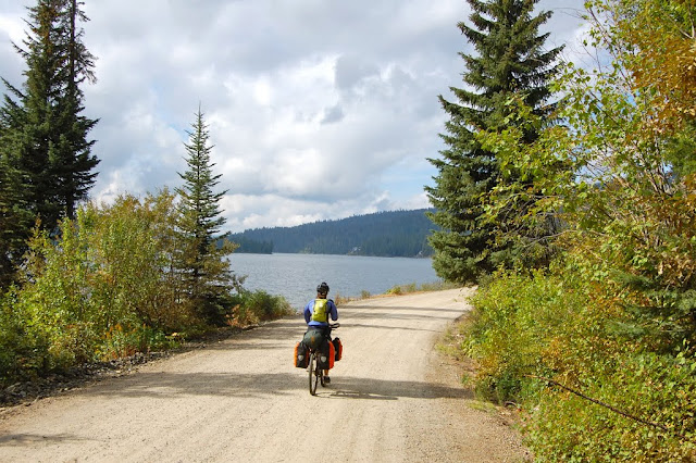
After a big breakfast at McCall's Pancake House we dropped off the automobiles at the cabin of a friend of Jen's, and rode along Payette Lake, climbed to Upper Payette Lake, and on up to the first pass of the day on paved roads with little traffic. A rapid descent on pavement to the intersection took us within 2 miles of Burgdorff where the pavement ended and the smooth hardpan began.
 |
| Jen along Payette Lake - Photo by Doug |
 |
| Reading about the 1994 fire while observing the damage from repeated fires - Photo by Doug |
Over another pass and on the other side we passed through Warren, an old mining settlement surrounded with dredge tailings. The smooth hardpan had deteriorated to a more typical decomposed granite for the ride over Warren Pass followed by a rapid fall into the canyon of the Salmon River's South Fork where we'd camp at Shiefer Campgrounds. The South Fork was warm enough for a short but pleasant after ride swim.
| Looking back across the bride that took us into Shiefer Campgrounds |
17 Sep 2011
Shiefer Campground to camp at edge of the road
29.0 miles, riding time 6:17, elevation gained 6,184 ft
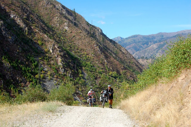
We had all evening to stare at the steep canyon walls we'd have to climb first thing in the morning. After a short steep section we rode along a bench, saw a small cemetery, and then the climb up Elk Creek really started! I like staying in my 23" gear, but much of the hill forced me to ride in a 19" gear (my Granny-one). Doug likes a higher gear and standing, but it was too steep for that style riding. It wasn't long and Scott, Jen, and Doug were all pushing though all are stronger riders than I. My early introduction to road biking taught me to "gear down" and peddle saving energy while maintaining a slightly faster speed. The climb took most of the day. By the time we reached the top, I was still only pleasantly tired. We hoped to reach Yellow Pine, where we could eat in the cafe and snack in the grocery store.
 |
| Steve catches Scott on Elk Creek Climb - Photo by Doug |
| Scott and Jen enjoy their PB&J lunch |
| We've reached the top, or have we? |
As expected we started down steeply after reaching the top, but after a mile or so of descent, we started back up! Now, you may look at the daily mileage of 29.0 and think this was an easy day, but you'd be wrong! Temps fell rapidly at the first peak from 52 to 48, and then down to 46. I was cold and ready for a 2nd lunch when I finally put on my lobster gloves and windbreaker. Somewhere along this section I abandoned my idea of riding every part of the ride, and with a slightly aching lower back began pushing my bike up the steepest section! We were now in the Middle Forks' drainage area, and Yellow Pine lay over another pass back on the South Fork, so we abandoned the plan of steak dinner with pie for dessert!
When we reached Big Creek, our 2nd choice of a "campground", we saw a campground with 1 occupied spot; the rest was under construction, no tables, no parking, no spot for tents. We considered putting up our tents in the center of the "under construction" road, but we decided to ride on. Doug's quick eyes spotted a turn off into the forest and a small clearing. As soon as the tents were up, Scott started dinner, and doubled the portions since everyone was hungry. We were all in bed by nightfall.
| During the night a few big drops of rain fell, so Scott put up this cover for the breakfast cooking. The sky cleared by the time we were back on the road |
18 Sep 2011
Roadside camp to Ponderosa Campground (not the state park)
41 miles, 4:42 riding time, 2,229 ft elevation gain
Being overly tired, I slept soundly- a leg cramp in the middle of the night barely woke me long enough to stretch it out. Jen wasn't so lucky. Her's was more severe, and she was afraid she'd awoke the entire camp as she fought to get rid of it. Though we were all in our tents by nightfall, I wasn't really ready to get out of the tent 10 hours later! I awoke still tired from the prior day's ride. Immediately, we headed up another mountain and the effort brought me to full alterness. Down the other side lay Yellow Pine where the only grocery store and cafe of the trip lay. Hamburgers and fries for the entire group that's close to health nuts! Then we were off to the grocery store, but on Sundays it opens late, closes early, and closes when the employee decides it's lunch time which happened just as we finished our lunch, so we missed this restocking opportunity.
Scott had mapped two versions of the trip. The group was still a bit tired, so we switched to the shorter route as we left. The locals were amazed we were taking the washboard version when the other route was mostly paved and only 17 miles longer. Is a 17 mile shortcut on washboards worth it? The ride down the South Fork on pavement and then decomposed granite was speedy and scenic- maybe the best of the ride. Then the route turned up the Secesh River, a moderate side stream, where the washboards the locals warned us of began. Soon we were shifting from the right side of the road to the wrong side or even the middle looking for the least bounce. We were all ready for an early end of the day, so the roughly 3:00 arrival at Ponderosa Campground on the Secesh River was appreciated. I swam while the others took bird baths at the campground's faucet.
19 Sep 2011
Ponderosa Campground (not the state park by that name) to McCall, Idaho
29.3 miles, 4:06 riding time, 3249 ft elevation gain
One last pass to climb today as we crossed back into the Payette River System. The forest and the mountains were beautiful. The severe washboards continued as did our bouncing from side to side of the road trying to avoid them until we hit a few miles of construction just before the pavement. The entire time in the Salmon drainage was characterized by rapidly flowing small rivers with crystal clear water. Back in the Payette drainage they were slow moving quite waters as would be expected in mid Sep.
| Scott, Jen, & Doug climbing out of the Salmon River Drainage |
This was another great trip though I admit the climb on Elk Creek took a lot out of me, and despite the ideal weather, I was actually glad to be done with the ride- an unusual reaction for me. With one day back at work though, my tiredness is finally gone!
Check out Doug's Blog and photos
Happy cycling for fun, fitness, & transportation
Steve
