17 October 2019

Mountain Biking Moab 2019

I'd picked Will up in Salt Lake for the roughly 5 more hours of driving to Moab.  When we arrived, we headed for the bike shop to pick up Will's rented 27.5" Canondale Trigger which he'd researched, particularly wanted, and had pre-paid the rent. Well, with an explanation that they'd sold the bike that they had rented to him and without an apology they offered him a 29" Canondale Habit.  A couple of years ago he'd rented a 29er in Spokane and was sure he didn't like them, and he particularly wanted the "Trigger" which lets him adjust his rear shock from the handlebars a feature the Habit doesn't have.  He reluctantly accepted the substitution, and we took off for a short "shake down cruise" to make sure it fit and get a bit of exercise after a day of travel

Day 0 - Wed 2 Oct 2019
Virginia Motel to Sunset Grill & on to the Colorado River Bridge

8.0 miles  1:00 riding time 432 elevation gain

I thought we were just headed down to the bicycle bridge over the Colorado River where we'd take a photo or two and test out Will's rental bike for fit and obvious mechanical issues, but when Will noticed the steep ascent to Sunset Grill, we had to climb that pavement which my GPS showed had a maximum grade of 19%. It had a good overlook of Moab.

Steve & Will on the bicycle bridge over the Colorado
Steve with Moab in the background - taken from the Sunset Grill

Day 1 - Thur 3 Oct 2019
7-Up Trail and Bull Run Trails

31.0 miles  6:03 riding time 432 elevation gain

We were unsure of the amount of time this ride would take, so we drove hwy 191, turned SW on hwy 313 , parked, and rode our bikes up the steep road to the unmarked trail head skipping the roughly 12 miles (each way) of mostly paved bike path from Moab. With no sign, Will's GPS was all that showed us where the trail head was.

Will at the first sign verifying we were on the 7-Up Trail more than a mile after leaving the road
Will on the 7-Up Trail

 another scene on the 7-Up Trail

Will on 7-Up Trail
Steve on his hard tail coming down some light drops (I believe we're on Bull Run here)

We had planned to go from "Bull Run" on to ride five of the "Magnificent Seven"  On the hard tail I was finding  "Bull Run" too technical to enjoy, and the last two of the Magnificent Seven are for "Experts", so we caught a Jeep Trail road back.  The hard tail was good for the up hill on 7-Up.

Steve with the road below him
One last climb awaited us.


Steve in the difficult lighting above Moab Canyon; we'll rapidly drop down to that highway


Day 2 - Fri 4 Oct 2019
to Arches National Park via Sovereign, Hot Dog, Red Hot, Carousel, The Edge Boondock, and a few other trails

42.0 miles  5:43 riding time 1,988 elevation gain


The weather for this trip was nearly ideal letting us escape the early cold front that had settled over the Pacific Northwest and even down to Salt Lake, but today was forecast to be windy with gusts up to 45 MPH.  We'd stick to the plan.  We've seen the park (which is great) and enjoy the trails that run near Willow Creek Rd getting there, so we rode to the boundary and on to the park's main highway where we turned around.


Steve over the canyon alongside the Sovereign Trail


Will - the trail descending is more challenging than it appears
Steve may or may not have ridden all the way down this rocky hill that is the hill behind Will in the last photo
Will on a more typical (and pleasant) trail for the day


Steve & Will at the entrance to Arches NP
Will on a sweet section of trail
We stopped at the Chevron Station about 12 miles out of town for ice cream where the worst of the wind caught us with gusts that may have reached the predicted 45MPH as we were enjoying that ice cream. The severe wind didn't last long, but we still fought a significant headwind down the bike path to Moab, but it was paved and downhill.


Day 3 - Sat 5 Oct 2019
Monitor & Merrimack, Wipe Out Ridge, and Ramblin' Trails

48.7miles  6:43 riding time 3,347 elevation gain


We'd done Monitor & Merrimack in 2018, and we both wanted to do it again, but Will wanted to change the route, and I agreed as there isn't enough light in Oct to do the 2018 route which had taken us into Arches National Park after circling Monitor and Merrimack.  The 2018 route had some sandy sections that were doable because it was downhill.  This revised route required some pushing as there was a lot more sand and most of it was not down hill.  


Will on some of the "slick rock" near Monitor and Merrimack
Will in more slick rock
Steve just before the slick rock turned to sand!
It's now sandy and hard to navigate but mostly ridable. Monitor & Merrimack in the background
We're through the sand and onto "Ramblin'" where Will is enjoying the slickrock
Ramblin' Trail was a pleasant surprise coming out of all that sand.  It had a little bit of everything: slick rock, sand, smooth trails, twists, and changing terrain, and may be one of my favorites.


Day 4 - Sun 6 Oct 2018
Most of the Whole Enchilada

33.8 miles  5:09 riding time 1,499 elevation gain

I knew the Whole Enchilada was the highlight of the trip for Will, but last year I hadn't enjoyed the portion above Porcupine Ridge as it was too rocky. Still, I was willing to go for it. Last year's snow made them drop us off at "Hazard County", but this year we'd go all the way to the official starting point on the far side of Burro Pass.  Climbing from the drop off point to Burro Pass was challenging and fun though we both had to push for a short way, and at 11,150 ft we knew we were short of oxygen.  When we reached the summit, we were ahead of most of the roughly 36 people who'd arrived with us on 3 shuttle vans.  


Steve and Will at the top of Burro Pass


Burro Pass elevation 11,150 ft
A small portion of the group at the top of Burro Pass - photo by Will

The initial descent was fun with some rock, but then we turned a corner, and the trails seemed to be mostly 5" rolling rocks buried to various depths in 6" of fine dust.  I found myself going slow trying to control the bike.  Will rode this section with Patrick, who had been crowded into our seat in the shuttle ride, and his girlfriend Stephanie fell back with me.  Steph then announced that the trail was too technical for her.  Right, it was also too technical for me, and as we went down this hill most of the 36 people who had been behind me were now passing me.  I tried to speed up just a bit, but my desire for control was too strong, and I did an endo bruising my chest and thigh and scraping my leg just below my knee. My bike nearly fell on its derailer, but I saw that in mid-air and deflected it with my foot.  I was glad the bike and knee escaped injury, but my confidence was gone as I kept hearing Steph say the route was too technical for her.  My thigh didn't want to work the rest of the day, and my preference for uphill was strengthened.  This combination of rocks buried in dust lasts quite a while longer, and as I was pushing through it nearly everyone passed me.  I did notice that no one seemed in control of his bike.  Back wheels were fish-tailing in one direction and front-ends doing the same in un-coordinated movements.  However, other riders were speeding, hooping, and laughing all the way down with little or no use of the brakes.  I also  met a young man who had broken his derailer off, and whose attempts to shorten his chain had failed giving him no chain.  He coasted down and pushed up the hills as he headed for Sand Road where he hoped to make a rapid descent to Moab.


Scenery near the site of my wreck
I thought Will might be waiting for me at "Hazard County", but no one was there.  Then it was back uphill for a short pleasant while.


The climb up from Hazard County brings this kind of scenery - photo by Will
Near the top after climbing out of Hazard County - Photo by Will
My chest hurt with each breath, my thigh hurt with each peddle stroke, and my confidence was gone, so I was pushing on most of the downhills until the trail meets the Kokopelli Trail where Will was waiting for me.  It turns out he, Patrick, and Stephanie had all had endos, but with no broken body or bike parts and with their confidence still intact and!  


Steve back on his bike on the Kokopelli Trail - photo by Will
View of the valley
Will resting after lunch
Steve from their lunch spot
Like the guy with the broken chain, Steph planned to abandon the ride at Sand Road taking it back to Moab, and from shortly after my wreck that was my desire though I wanted Will to enjoy this ride and I really like riding down Porcupine Rim although it tests my technical skills.  Will gave up Porcupine Ridge and accompanied me back to Moab on Sand Road.


Day 5 - Mon 7 Oct 2019
Klondike Bluff Trails: Jurasic, Jasper West, Agate West, Chilkook Pass, Homer, Alaska, Old Salty, Baby Steps, UFO, Klondike Bluffs, and Jurasic Trails

22.6 miles  3:53 riding time 1,732 elevation gain

My thigh and chest hurt less than yesterday, but my attitude wasn't as positive as it should have been when we started out.  However, today my leg was functioning properly, and soon my confidence and enjoyment of the ride increased, but I notice nearly all the photos were taken by Will.

Klondike Bluffs Trailhead - photo by Will

Steve on some of the slick rock - photo by Will
Steve on these very enjoyable trails - photo by Will
Will on his 29er Habit
Will
Big rocks, but well designed trails!
Steve riding the ridge -photo by Will


It was another great trip although I'm unlikely to attempt The Whole Enchilada again.  Thanks for the memories Will

Online maps seem better each year, here's the maps we relied on

Happy bicycling for fun, fitness, and transportation


Steve

2018 Moab trip

2016 Moab trip

2010 Moab trip


10 September 2019

Bicycling the Great Parks North

Staff at Tom's work had been encouraged to consider extended time off this year which helped plant in Tom's head the idea of a long bicycle tour this summer.  When that changed, he worked hard to come up with another plan, and by the time one was hatched, he and his family had little time for training and were rushed on the planning.  He'd done the Great Parks North in 1986, and decided to take his family plus me on that route with barely enough time to get the bikes ready.. He correctly observed that he "didn't need a team that can, but a team that thinks it can".

Day 0  Mon 12 Aug 2019
outskirts of Missoula MT to Shady Spruce Hostel 
7.6 miles, 0:39 riding time, 25' elevation gain

Logistics had been a nightmare.  Despite Spokane's close ties to Calgary, no buses nor trains run between them.  No rental car drops are allowed.  Airline connections from Boise are complicated and expensive ($1,000 one way).  My friend Linda, who's living in the Idaho Panhandle, agreed to drop me off in Missoula and with her son pick me up in Jasper.  Planning the camping in Canada was also difficult as Canadian parks have no hiker biker sections.  I turned all those problems over to Andrea, so she and Tom were probably thinking they had 3 kids to take care of.  

Linda dropped me and my assembled bike in Missoula about lunch time, so we had lunch with the family, and Linda headed home.  

Linda drops Steve off in Missoula. 

The family's bikes had been shipped from Rhode Island to the house of a friend of Tom's where we went after lunch to start putting bikes together.  That was slow work, and with one bike left to be put together (think small boxes and many parts), the teens and I rode bikes back to town between dusk and twilight without lights which were back in the motel/hostel. The teens were good at calling out potholes and railroad crossings which weren't easy to see in the fading light.

Putting the bikes together in Missoula.  Don, Steve, Tom, Andrea, and Emma


Day 1 Tue 13 Aug 2019
Shady Spruce Hostel/Holiday Inn to Seeley Motor Lodge Seeley, MT
54.8 miles, 5:45 riding time, 1939' elevation gain

We stopped by Adventure Cycling to  weigh-in the bikes.  At 94 lbs, mine was the heaviest,  but I pack impractical items like a laptop, plus my water bottles and gas bottles were full, unlike the rest.  Tom carries the tools and weighted in just below me.


The crew ready to depart Missoula: Henry, Emma, Steve, Tom, and Andrea

Making our way out of Missoula
Since the family didn't really train, I was concerned about our ability to meet the plan which included many prepaid camping and hotel reservations.  We were lucky that the extreme heat of early Aug was gone, but the day was still hot and uphill. The pavement North of Clearwater had just been seal-coated, was rough and felt sticky plus we had a mild head-wind.  I was in the lead going 6 to 7 MPH wondering why my speed was so slow, but no one was on my tail.  At Salmon Lake the pavement and wind changed, and the ride was again pleasant for me though some were spent, so we moved slowly into Seeley Lake.  Seeley Lake Motor Lodge offered me a campsite and the family a motel room. It was nearly dusk when we arrived with a tired crew. While we ate out full darkness fell. This first night of camping my Hubba Hubba tent pole broke at the junction where the cross poles meet which left me unsure how to use the supplied boot.  We put an unsatisfactory clamp on the broken pole which kept it from tearing the tent and made the tent temporarily functional.

Tom departing the Seeley Lake Motor Lodge

Day 2 Wed 14 Aug 2019
Seeley Motor Lodge Seeley, MT to USFS CG at Swan Lake, MT
61.3 miles, 5:34 riding time, 656' elevation gain

After breakfast Tom and I went for supplies in Seeley Lake which also offered a hardware store where we bought a clamp for my broken tent pole. The team was a bit tired, but we got out of town by 10:00 a.m.  They benefited from a fairly easy day that was often downhill.
i
at the hardware store for a clamp for my broken tent pole and Tom's bike loaded with groceries

on the road this beautiful morning: Andrea, Henry, Emma, and Tom

Views were good all day
Henry
Lunch at Swan Valley Center where we bought much to go with our PB&J sandwiches

enjoying the rolling hills
The other tents were erected before a short burst of rain, but I was struggling with my clamp, so my tent was erected wet but with the clamp in place.  The campground offered no showers but a lake.  Tom and I swam; Henry took a bird bath, and the women headed back to Swan Lake where the motel offered showers which in retrospect took too much time.  Dinner was eaten in the last light of day and clean up was after night fall.


Day 3 Thur 15 Aug 2019
USFS CG at Swan Lake, MT to Columbia Falls RV Park, Columbia Falls, MT
47.4 miles,  4:29 riding time,  846 elevation gain

We awoke to fog after a little rain fell during the night.  It would be another easy day before tackling "Going to the Sun" tomorrow. There was no "current bush" to charge my GPS, so I'm using my old cyclometer for mileage and time and Google for elevation. 

took a break here and bought some excellent local cherries
fog was soon lifting
 

Henry and Tom on a quiet road
Emma on another quiet road
There was variety on today's ride: farm fields, mountains, and forests, but everyone questioned Google's assessment of only 846 ft of climbing.


Columbia Falls and the RV park were both nice places. The bike shop had little inventory except for new bikes, so Henry got no new gloves to replace those he'd lost on day one.  We set up camp, went to Dairy Queen, ate out, and after dark bought groceries for the next day.  


Day 4 Fri 16 Aug 2019
Columbia Falls RV Park, Columbia Falls, MT to Sprague CG or Glacier Lodge
33.4 miles,  3:44 riding time,  623 elevation gain

Some of the back gravel roads getting into the park were rutted with bad pot holes and some speeding commercial traffic.  The family stayed in the lodge and I stayed in the hiker biker section of Sprague Creek Camp Ground less than 1/2 mile away.  We had dinner in the lodge and made plans for the "big day" tomorrow.

Day 5 Sat 17 Aug 2019
Sprague Creek CG and Glacier Lodge to St Mary, MT
41.7 miles,  5:08 riding time,  3,698 elevation gain

The big day of climbing that everyone was worried about had finally arrived.  The plan was to leave the lodge at 0600 hours - an hour before dawn.  I'd like to have eaten at the "all you can eat" breakfast buffet that started at 0630, but I'm not that much faster than the group.  We were off within 10 minutes of the plan with lights blazing in a light mist. Park rules say that bikes must be off the Going to Sun highway by 1100 hours.  Emma in particular was determined she wasn't going to be caught short or finish last.  That attitude make her the first one to the top.  

Emma, the last time I saw her before she dropped us all on Going to the Sun Highway
 
Andrea on Going to the Sun Highway
Tom climbing
Henry on the climb: Going to the Sun


The sun's rising; time to turn off the lights


At the top: Tom, Steve, Emma, Andrea, and Henry
Once at the top we added a hike and got these two photos:

This mountain goat wasn't shy and came quite close to us with her kid
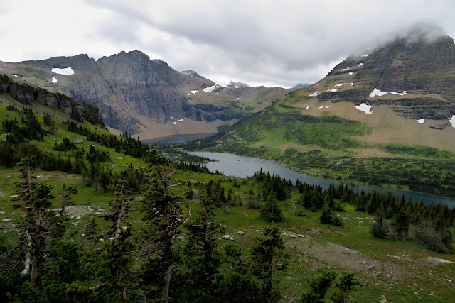
view of Hidden Lake at the top of the 5.4 mi hike with elevation gain of 1,325 ft in addition to what we'd ridden
There were some faces pale with fatigue, but the crew that thought it could, did.  Touring involves more than riding through interesting country, so we hiked the 5.7 miles to Lost Lake and then coasted down to a late lunch at the Rising Sun on the east side of the park. We rode into St Mary and bought food at the big convenience store there and on to the private Johnson's campground.  There Andrea received the worst advice of the trip.  In answer to her question "Do you have bear boxes?" she heard, "just put the food in your tent, and you should be OK".  Despite this advice, we hung the food in the trees.


Day 6 Sun 18 Aug 2019
Johnson Campground St Mary, MT to Waterton Lakes, Canada
49.2 miles,  5:49 riding time,  3,698 elevation gain

The big day was yesterday, but today has 75% as much climbing and 8 more miles with a  crew that's starting the day tired.  The ride to Babb was pleasant with a strong tailwind.  Babb surprised us with a nice place for a 2nd breakfast.  As we climbed into the mountains and trees, the tailwind became less noticeable.

Johnson's Campground at St Mary, MT
Henry finishes his 2nd breakfast in Babb
14 hilly miles to the border as we left Babb
I expected rolling hills of the plains, but we climbed back into the foothills and then the mountains that were continually more beautiful.

Andrea with Chief Mountain in the background
Crossing the border into Canada: Tom, Henry, Emma, Andrea, and Steve
Emma's front derailer wasn't working most of the day, and Tom was often reminding her to have him manually put it in granny rather than power up the hills.  Emma unloaded her bike behind the border crossing, and Tom attempted to adjust the derailer, but it still caused her a headache all day.  

Tom working on Emma's derailer
The day was tough on the crew coming the day after Going to the Sun.  A pleasant guy in a van offered to take the obviously tired down to Waterton, but everyone declined.  
Eventually the rolling downhill to Waterton began

Waterton Park recently added a bike path from its gate into the townsite, so we started in on it, but we found grades of 12% that greatly exceeded the grade of the road.  A bear on the bike path brought the last of us to the road. It was about sundown when we arrived at Waterton Townsite.  I was to camp while the family was in a motel.  They let me set up my tent before eating as nightfall was approaching, but I had trouble finding my unmarked camp site, so it took too long.  Darkness had fallen by the time I rejoined the group, and it was 10:00 p.m. when we were looking for a place to eat.  Finally we found a bar, but they wouldn't let Henry in, so we ordered greasy food to go and ate in the motel.

Day 7 Mon 19 Aug 2019
layover day at Waterton Lakes, Canada
10.1 miles,  1:03 riding time

My inadequate repair of the tent pole was beginning to threaten to rip the tent, so I headed to Tamarack where a couple of young guys looked at it as a challenge.  They rearranged the order of the poles moving the broken pole toward the base of the tent  allowing me to use the boot which wouldn't fit over the "joint" of the poles.. Repeatedly running between the campground, Tamarack, and the motel gave me 10 miles for the day.

The clamp was giving up.  Employees at Tamarack rearranged the poles allowing for use of the boot and reviving the tent
 After an early dinner at the Waterton Hotel, we took a tour boat ride up the lake at sunset.
Waterton Lake
view from the boat ride

Day 8 Tue 20 Aug 2019
Waterton Lakes, Alberta to Lost Lemon private campground Blairmore, AB
69.2 miles,  7:03 riding time elevation gain: 2,313

The layover day had revived everyone, and undue tiredness would not be a problem in the future.  


Tom departing Waterton Park
cycling thru farm country north of Waterton

We met the Andrews, a couple from Michigan, who were leaving Canada disenchanted.  They hadn't made reservations in the park which had no room for them. They were turned away and threatened with fines for unauthorized camping and asking other campers if they might set up in their spot and pay for it.  I'm so glad Andrea took charge of our logistics!

Although there was no undue tiredness, the group was tiring in the hot afternoon, so we rode a mile or so off route to the Beaver Mines General Store for a break of cold drinks and ice cream which revived all.

Beaver Mines General Store - where everyone was revived
 
Emma, Andrea, & Steve

We got in late, so we rushed to get our tents up by nightfall, ate out, and didn't do justice to Blairmore or the Lost Lemon CG which looked to be a nice place. Of course, late arrivals make for a late departure the next day.

camp at Blairmore the next morning.  The photo's time stamp shows it 0939, and the tents are still up


Day 9 Wed 21 Aug 2019
Lost Lemon private campground Blairmore, AB to Raging Elk Hostel Fernie, BC
44.8 miles,  4:24 riding time elevation gain: 856 ft

It was slightly uphill to the Continental Divide at Crowsnest Pass which we crossed putting us in BC.  The sign is over a mile from the provincial border and the divide and is directly behind a permanently installed trash can which don't make for the photo op we had hoped for.

this unglamorous sign marks our passing back into B.C.
 We had a great lunch from the grocery store in Sparwood and had our photo taken in front of the former largest truck in the world.  

best lunch of the trip in Sparwood, BC from the grocery store across the street
 
Steve, Emma, Andrea, Tom, & Henry in front of the former largest truck in the world


Day 10 Thur 22 Aug 2019
Raging Elk Hostel Fernie, BC to Fort Steele, BC
61.8 miles,  5:57 riding time elevation gain: 1,654 ft

Enjoyed the Raging Elk Hostel and spending some time with Joe & Tom
We spent the night at the Raging Elk Hostel which offered good laundry and a nice kitchen which we didn't use.  I was in a bunk room with air conditioning, and the family was in a family room without it, but they weren't required to tear apart their beds.  I spent some time with two Great Divide riders, Tom and Joe, and met a couple others.  Earlier when I was having trouble with logistics, I had considered riding to Fernie and looping back to Idaho- a possibility for other riders.

Most of the morning was spent on busy hwy 3 which made us consider the gravel alternative. In the afternoon we were back on pleasant back roads for a while before rejoining hwy 3 which in the afternoon had even less shoulder and more commercial traffic


Quiet back road of the afternoon:  Andrea, Henry, and Emma
Emma, Henry, Steve, and Andrea enjoying an overlook as we escaped hwy 3 for a second time
Emma & Tom enjoy a swim at Norbury Lake
Tom was eager for a swim, and Norbury Lake was beautiful.  Henry was in the lead and missed seeing the lake, so he and Andrea missed the swim.  We'd gotten an early enough start that the swim was an option as well as washing clothes which we hadn't done the night before in the hostel. We had a spacious site.

Campsite at Ft Steele, BC
 

Day 11 Fri 23 Aug 2019 
Fort Steele, BC to Fairmont Hot Springs, BC
55.4 miles,  4:44 riding time elevation gain: 1,362 ft

We had the best breakfast of the trip in Fort Steele: pancakes with nutella, banana slices, and blueberry syrup.  It may sound like too much, but not for hungry cyclists.  We spent most of the day on hwy 93/95 which is still too busy but from here had good shoulders. We were on back roads part of the day which is where the photos were taken.. Despite the short day, we arrived too late to go to the hot springs and do laundry, so we promised ourselves an earlier arrival at Radium Hot Springs the next day.

Andrea the Kootenay River
Henry, Emma, Steve, & Andrea

nearing Fairmont Hot Springs, B.C.

Day 12 Sat 24 Aug 2019
Fairmont Hot Springs, BC to Radium Hot Springs, BC
32.6 miles,  3:54 riding time elevation gain: 679 ft

A short day and a late start today.  The morning into Invermere was along a back road, and soon I noticed a beside the road new blacktop bike path that was designed with steep hills - unlike the road.  With a short day in play, I got on the bike path and with fresh legs enjoyed the unnecessary steep climbing.  The rest of the group stuck to the quiet side road.

Andrea, Emma, & Henry leaving Radium Hot Springs

 
new bike path between Radium Hot Springs and Invermere, BC which is  popular despite its steepness 

Invermere is a pleasant touristy town
Everything changed as we left town.  We were suddenly shuffled off to a narrow steep bike path between a New Jersey barrier and a wire fence.  Then we were back on busy hwy 93/95.


Tom on the horrible ascent out of Invermere.  If you think he barely fits, you're right.
Henry finishing the climb out of Invermere
We had planned to stay at Redstreak Campgrounds, but Tom & Andrea changed to a motel.  I thought I'd remain at the campground, but when we arrived in town, the campground was on top of a nearby mountain.  That didn't work well with the plan to clean up, eat, and ride up to the hotsprings, so I slept on their floor at the full motel.

Radium Hot Springs
Henry enjoying relaxing at the hot springs
a mountain sheep ram enjoying relaxing behind our motel
  
Day 13 Sun 25 Aug 2019
Radium Hot Springs, BC to Kootenay Park Lodge at Vermilion Crossing BC
39.8 miles,  4:46 riding time elevation gain: 2,700 ft

The Alpen Motel was a good place to stay and we enjoyed the many mountain sheep around it

The gorge going into the national parks
The climb going into the park was steep, so steep we got on the sidewalk for the steepest section, but it soon leveled somewhat.  

Sinclair Pass  elevation 4,875'  Most of it was 6% but 8% and 10% were not uncommon
 
back in the Kootenay River Valley; the cold side of the mountains according to last night's waitress which seemed correct

my favorite lunch spot along the Kootenay River

We spent the night in a cabin at Kootenay Park Lodge
limited menu but excellent dinner at the rustic Kootenay Lodge


Day 14 Mon 26 Aug 2019
Kootenay Park Lodge, B.C.  to Banff, AB
30.8 miles,  4:47 riding time elevation gain: 2,028 ft

It was so cold this morning that I wasn't sure I was opposed to the late start.

Steve and Emma ready to depart
  
views as we left the lodge
Steve along the Vermilion River


Henry & Steve


nearing Vermilion Pass Emma, Andrea, Henry, and Steve
Snacks are part of touring.  Here Henry enjoys a red licorice break.
Henry and Emma at the divide where we crossed back to Alberta

Castle Mountain where we diverted from the route to go to Banff

nearing Banff
back road into Banff
entering Banff
We got to Banff a little later than we should have, so the next day was planned as half a day spent on bikes and half a day of play.  Because motels were generally full, we ended up in separate motels a couple blocks away from each other.


Day 15 Mon 27 Aug 2019
layover Banff, Alberta Bad News
0 miles,  0 riding time elevation gain: 0 ft

We'd planned to meet at 0900 hours to do laundry, but when I arrived at the family's hotel, Tom was somber faced sitting in the lobby.  His father would be having a heart procedure later in the week, and the family had to fly home.  Bad news for all of us.  We spent the layover day getting their bikes to a bike shop for shipping; the family rented a car, we drove around a bit, and had a big dinner that was more of sorrow than celebration.  Despite my negative feeling about riding and camping solo in grizzly territory, Brian was looking forward to the drive all the way to Jasper, and I was here probably for the only time in my life, so I decided to finish alone.

Continued as Bicycling the Great Parks North Part II