08 October 2012

Old West Scenic Bikeway - Back to the Blue Mountains

While mountain biking in the Blues last August, Doug mentioned he'd be interested in a short tour this fall, and with my retirement scheduled for 30 Sep, we quickly worked out a plan to return to the Blues on road bikes- we ended up on RideOregonRide Old West Scenic route beginning and ending in John Day. A cold dry front arrived the day before departure bringing cold and steady Western winds that weakened a bit each day.

John Day Oregon to Bates State Park 33.7 miles 3:00 hours riding time
We met in John Day where we had lunch and headed up the John Day River passing through Prairie City (all services) before beginning the steep climb to about 5250 feet elevation, and dropping back down slightly to Austin Junction. Camping and showers were available, but we decided to ride on down to the new Bates State Park only 1.5 miles away.

4 day ride on the Old West Scenic Bikeway Oregon

Setting up camp at Bates


We rode back to the Austin House for dinner- salmon for me and some fish medley for Doug. We rode back to camp at dusk. Temperatures were falling rapidly, so we both crawled into out tents preparing for a cold night.

Day 2 Austin Junction to Long Creek, Oregon 52.8 miles 4:30 riding time
It got colder than we expected falling into the mid teens. I stayed warm curled up in my sleeping bag, but the cold kept me there for nearly 12 hours- nights are long this time of year. Doug suffered a bit in the cold. We both got up shortly after dawn and walked back to Austin House which doesn't open until 0800 hours PDT. The temperature was 18 as we were finishing breakfast. It was still below freezing when we stuffed the sleeping bags and loaded up the bikes. We stayed bundled up and took off with a steady but mild head wind.

4 day ride on the Old West Scenic Bikeway Oregon
Bundled Steve departing Bates

4 day ride on the Old West Scenic Bikeway Oregon

Fall Colors had begun with arrival of the cold front that characterized our ride


Bates is near the headwaters of the Middle Fork of the John Day, and the route followed its winding path down into the steady head wind. When the river met highway 395, we turned south to follow the state highway with minimal traffic but with another steep climb. We crossed some high desert arriving in Long Creek in late afternoon. Although camping was available, we headed to the Long Creek Lodge to avoid another night like the last one. I had no desire to lie in a warm sleeping bag for 12 hours to stay warm, and Doug had no desire to chill for 12 hours in his. The town of Long Creek doesn't offer much, a motel and a convenience store where they'll fry hamburgers- but be warned it closes at 1800 hours PDT- pretty early for cyclists. The motel worker warned us the store didn't open until 1000 hours, so we bought breakfast foods to add to the instant oatmeal Doug was carrying. The convenience store clerk said they usually opened by 0900, but that too sounded too late.

Day 3: Long Creek, Oregon to Dayville, Oregon 61.2 miles  5:02 riding time
The temperature was again below freezing with ice on the side of the road as we left town, but it was much warmer than the night before, and unlike our tents, the motel had heat.  The motel clerk warned us the route would be busy and the road winding.  The latter was true, but we saw only a couple cars between Long Creek and Monument.  Most of the ride down was windy and steep, but that makes it fun.  Oddly the temperatures were colder at the bottom, and I added a sweatshirt to what I was wearing as we left Monument's grocery store.

4 day ride on the Old West Scenic Bikeway Oregon

Steve departs Long Creek
 
 
Doug enjoys the descent to Monument
 
4 day ride on the Old West Scenic Bikeway Oregon
Steve beginning the climb up the South Fork of the John Day

The huge well maintained Kimberly Orchard added to the interest of the ride about noon.  At mile 42 we arrived in Kimberly, but were disappointed to find both the store and restaurant were closed- with the appearance the closure was permanent. We stopped by the Fossil Bed National Park and the Cant Ranch Museum which are only about 100 feet apart and enjoyed the break, the sights, and then riding through the Painted Canyon.  When we arrived in Dayville, we had the choice of an RV Park, or the Presbyterian Church which has allowed bicyclists to stay for free since touring took off in 1976.  I'd never stayed in Dayville despite riding through the Oregon section of the Trans Am several times, and reading some recent blogs made we want to check out the church.  It turns out they were having a "harvest auction" that evening to raise money for the assistance they give the poor of Dayville.  The harvest auction includes fruits, vegetables, and baked goods; stuff a cyclist would really like- except where will it fit in the panniers?  They assured us we wouldn't be in the way, and invited us to their pre-auction chilli feed and auction.  Small town activities always entertain me well on tour, so this just added to the adventure for me. I think Doug enjoyed it too; it beat watching PBS and old sitcoms the night before or the first night's huddling in the tent to stay warm!


Goods to be auctioned at the Harvest Auction- fuzzy photo by Steve
 

4 day ride on the Old West Scenic Bikeway Oregon

Our Bikes where they spent the night in Church
 
 
4 day ride on the Old West Scenic Bikeway Oregon


A stained glass gift to the Church from a previous bicycle guest


Day 4 Dayville, Oregon to John Day, Oregon 31.5 miles 2:46 riding time
Despite the cold which still hadn't left the area, we left early- not wanting to stay for church or be underfoot when the first members arrived.  Finally, we had a slight tail wind  pushing us up the valley to John Day.

It was a great October trip that would have been better without that cold front, but still definitely worth doing. Here's a hotlink to Doug's photos.

Happy Cycling for fun, fitness, and transportation!

Steve


17 August 2012

15,000 Feet of Climbing in the Blues

The major forest fires in Colorado in June forced us to change our mountain biking touring plan from a week on the Great Divide Route to one on the Salmon River.  In July South Idaho had more acres burning than any other state, so, Scott and Doug went to work planning a revised ride in Oregon's Blue Mountains. I don't believe I even got a copy of the last pre-ride revision, but that last minute route was changed freely enroute with the aid of USFS and chamber of commerce motorcycle map obtained enroute.

Day 1: La Grande to a Camp on the Edge of the Road 30.3 Miles 5:20 Riding Time

Doug, Jen, Scott, and Steve ready to depart La Grande


We met at 1000 hours PDT in La Grande and were underway by 1100. The gravel route up the mountain was steep as expected. When we reached the first fork in the road, Scott assured us it it would get less steep; it didn't. We continued up to an old log cabin where the gravel ended and the climb became less. The surface was dirt with some large naturally occurring rocks that had recently been dry graded leaving a lot of dust to disguise the rocks. The county or USFS apparently decided the naturally occurring rocks  weren't enough, so they hauled in 3" to 4" sharp rocks that were difficult to ride over and posed a danger to all bicycle tires making the riding almost as difficult as the climb had been. Eventually we rejoined the gravel road that we'd left 3/4's of the climb out of La Grande. We soon reached a ridge, and soon afterward Scott was bonking and out of water. A ridge is a bad place to look for water, and though we looked, we found none. When primitive camping on bike tour, I like to set up camp by about 1700 hours, but dry camping is a poor option- especially when we're out of water. By 1900 hours we did find a small pool of water with no place to camp. We thought there was a USFS site within 2 miles, so we rode on to a wide spot where people had occasionally camped. A cold spring was nearby where we could filter water, and with a 2' x 3' hole a cold bath could be had. Tents were rapidly thrown up, water filtered, and dinner cooked by dusk which happens about 2000 hours here in Pacific Time.We were all in our tents by nightfall.

First Night's Camp on the edge of the road


Day 2: Side of the road camp to USFS North Fork Campground 27.9 miles 3:30 riding time

The next morning saw a quick breakfast of oatmeal and a variety of nuts and toppings and a quick cleanup.
Jen, Scott, Jen, Steve on a ridgetop


Steve descends from the overview

The early morning ride was pleasant, but soon we reached a road surface like powder 3" to 4" deep. It was surprisingly easy to ride through, but it hid rocks and other hazards, was filthy, and was somewhat demoralizing.


Two cyclists in the light dust before it thickened

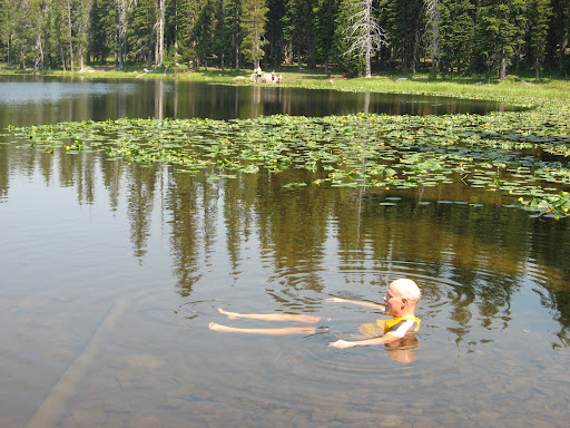
Anthony Lakes was the relief we had promised ourselves, but when we got almost there, we saw we had considerable descent to get there followed by a U turn and climbing back up to where we were. Lake Grande Ronde was just slightly offroute and roughly at our elevation, so we headed there for lunch, and to clean ourselves and our bikes a bit.

  Grande Ronde Lake where we had lunch


Doug enjoys soaking in Lake Grande Ronde


We were now on pavement for the ride down to the North Fork John Day USFS Camp where we arrived mid afternoon and enjoyed a another dip in the North Fork of the John Day. Doug was sent to some town 2 miles away according to Scott's GPS, but he came back without any treats.

Day 3 North Fork John Day Campground to Olive Lake 21.6 miles 2:41 riding time
We repeated those two uphill miles that Doug had done the previous day, verifying there was no store or town, then down about 7 miles miles to Granite, a village with a small convenience store that offered some Cisco meals they'd heat up. We all had a sausage/egg sandwich.

Doug, Steve, and Jen enter Granite

From Granite it was a mild climb up to the powerhouse where water in years past was piped from Olive Lake to the power house to generate power for the mines and this part of Oregon until 1967.


Jen and Steve tour the old powerhouse


The pipe that carried water from the lake to the powerhouse


It was a steep climb on up to Olive Lake, a mostly man made lake built to store water for power generation. When the powerhouse was abandoned, the reservoir became more lake and less storage reservoir.

View of Olive Lake


We arrived at the lake fairly early, so we did laundry, hiked around the lake, and Jen and Doug read. We met a friendly neighbor who provided us with fresh cherries from his orchard at Hood River, and provided us with a lesson in cherry growing and cherry types.

Day 4 Olive Lake to USFS Gold Dredge 38.2 miles 3:29 riding time
Day 4 was our easy day. It was down hill all the way to Dale, a rural convenience store, where we had hoped to eat in a restaurant. There was no restaurant, so we settled for a frozen breakfast burrito cooked in their micro-wave and eaten at their pic-nic table. Here we turned to go slightly uphill, and we picked up a tailwind! I was riding strong when we reached the fork in the road, up a water grade to a campground or up the mountainside for camping somewhere on top. We settled for the campground on the river and a short day.

Just before reaching Gold Dredge Camp Ground


Doug with the beer carried up from Dale and freshly filtered water


Jen with Doug seated at her right foot- at the Gold Dredge Campground


My favorite dinner of the trip


Day 5 Gold Dredge Campground to North Fork John Day Campground 38.1 miles 4:44 riding time

The reason for the early stop yesterday was soon evident as we started up the mountain side- steep and long, yet never a killer hill.

Scott, Jen, and Steve start up the mountain


Scott and Jen near the top of the mountain


View from the top looking back down on Gold Dredge Campground


Just after reaching the pavement on top we were surprised to meet a cross country cyclist- always a highlight for me. She was headed from Wisconsin to California via Portland. She headed on to Ukiah for the night, and we headed on to our 2nd night at the North Fork John Day CG. The road was mostly up and down with a steep downhill for the last 2 miles into camp where we set up camp exactly as we had 3 nights earlier. This was Scott's birthday, so he added an quick unloaded ride of unspecified miles to give him his age in miles.

We'd seen a couple of salmon pass by in the shallow river the first night, but this afternoon there were two males and a female in the shallow section of water at the campground.  The large male was probably 3' long and a master of the shallow water, easily sailing through water only half as deep as his body in this section of water they obviously knew well.  From watching documentaries I expected flailing and was impressed by the smooth movement these giant fish had through the shallow water.  As we stood perfectly still, they'd come within a couple feet of us, and we spent some time studying them. 

Day 6 North Fork John Day Campground to La Grande, OR 49.8 miles riding time 3:34
It was back up those steep 2 miles of pavement and then off onto a paved side road. Then over a hill, and down to the Grande Ronde River. We had planned on spending the night at a state park about 15 miles out of La Grande, but with the down hill and a mild tail wind, we decided to head back to La Grande a day early and celebrate with pizza.

Scott, Jen, and Doug on the paved road nearing I-84


It was another great ride- minus some of the issues of day 1 and 2, but it got us out of the smokey skies of Southern Idaho. Doug, Scott, and Jen had the meals well planned, and Scott's new water filter is nifty! All photos but the last are by Doug or Scott!


All Doug's Photos
 
Happy cycling for fun, fitness, and transportation,

Steve

18 June 2012

A Three Hour Tour- On Two Water bottles

"I'll have to skip church, but I have time to do a three hour ride beginning at 3:00", said the LT.  "That's no problem at all", I thought, as three hours in the foothills allows my favorite rides as well as the LT's.

I arrived about 5 minutes late with a freshly waxed bike, and we were able to skip what has become our routine before beginning a mountain bike ride; adjusting or replacing disc brakes on departure, so we were probably ahead of schedule.  Since the LT last week had diverted me to a bunch of soft bottomed motorcycle trails from his favorite ride, I suggested one of my favorite 3 hour rides- the Corrals & Freeway a route that wouldn't easily allow him to divert me onto those loose motorcycle trails again.  He was agreeable to that route, and we headed up Bogus Basin Road. 

Just before we reached the turn off to the Corrals trail, he suggested we ride on two more trails where he suggested a trail would take us up to Hard Guy, and from there we'd ride back down to the Corrals.  That was a surprise since I usually can't talk him into riding onto the next trail which adds a nice hill before rejoining The Corrals, but I was agreeable though totally ignorant about this 2nd trail.  My first impressions of that trail wasn't good- a 6" wide trail on the edge of a cliff which made me do some pushing while the LT rode on.

Steve after the trail widens enough for him to resume riding
 
 
Will climbing in the desert section
 
 
Will reaches the first tree 
 

 We started crossing the clear small stream every few hundred yards, and I drank my first water bottle wondering when we would climb out of this canyon up to Hard Guy. For the LT's "three hour tour", I had brought along 2 water bottles and had forgotten my orange- not a big deal on a "three hour tour"; that's a good after work ride near mid-summer's day.  Have I mentioned that the LT is too young to remember Gilligan's Island and its "three hour tour" that led to years of their being shipwrecked?

It was hot, so the LT suggested taking a break and cooling off in the shade. I soaked my feet and thought how much cooler and likely satisfying that water was than the hot stuff in my water bottles, but I'd just today finished reading a blog on the Great Divide  with the author taking similar action which led to 12 hours of puking. With that thought fresh in my mind, I refrained. Anyway, I was sure the LT knew what he was doing, and we'd soon be out of the canyon.

Steve at one of the many stream crossings- it was easier than it looks here
 
By the time we reached the first pine tree, I had drunk my last water bottle, and was thinking a lot about drinking from that cool stream. Even the LT was giving up on the idea that his route would loop back to Hard Guy. We thought we knew where this trail would come out- about 3/4's to the top of Bogus Basin Road. Neither one of us wanted to turn around- I knew I'd successfully climbed (or pushed thru) the 6" wide trail near where it left Bogus Basin Rd, and I had no interest in pushing DOWN that trail.

The LT reaches the first pine tree
 
Soon we were in the timber with some pleasant climbing in the shade, but the trail kept narrowing and getting steeper. We were reduced to pushing- on a trail too narrow to fit a pusher at the side of his bike. The LT's cell phone eventually regained service, so he tried mapping us. He suggested we abandon the trail- pushing our bikes through the brush up the steep mountain side in our lycra and bare lower legs! He ran out of water about this point, and I wondered if that lack of water was making him hallucinate- lycra through the brush pushing a bike up a hill nearly too steep to climb on trail?

By the time we reached the top, I was thinking about nothing but water, or a cold Coca-Cola. We were at the top of that trail- but we weren't 3/4's the way up Bogus Basin Road.  It took us a few minutes to realize we'd climbed to the top and were on the Boise Front Road that we'd ridden just a couple weeks ago although it took us a couple 100 yards to figure this out. It was 8:30; the LT's "three hour tour" should have ended 2 1/2 hours ago! We'd been hoping to turn left and descend Bogus Basin Rd, so we turned left, and started climbing to almost the peak of Deer Point. We met 2 downhillers screaming down, and suddenly the LT decided he'd like to turn around, and head for Hard Guy. Turn around? By this time I was really tired of trails and my technical skills had been pushed to their limit, so I wanted to stay on the road and zip down Bogus soon. The problem was, we had nearly 1,000 ft to climb before reaching the edge of Deer Point where we'd begin that zip down.

Once at the bottom, the first place I knew to get that Coca-Cola was the M&W Market, but to my surprise it is closed and had taken its pop machine with it. A convenience store 1/2 mile further on would have to do. It's nearly mid-summer's day which means light until 10:00 pm here on the western edge of Mountain Time, so neither one of us had headlamps, but to be seen we turned on our rear light there. We arrived back at the LT's just before 10:00 MDT. I drank 2 large glasses of water there and borrowed the LT's headlamp for the ride home. Dusk had turned to night by the time I arrived home where I drank 8 more glasses of water, and slept thru the night without getting up! Take plenty of water with you if the LT invites you on a "Three Hour Tour- a three hour tour".  LT, wha'd I ever do to you?

Total Miles: 41.7 Riding Time 5:24
Happy Cycling for fun, fitness, and transportation,


Steve

28 May 2012

Aldape Summit to Deer Point

Weather forced us to cancel our planned Memorial Weekend ride over the mountains to Idaho City, but the rain was supposed to stop by Sunday, giving us the opportunity for a day ride  up to Aldape Summit and across the Boise front to Deer Point. A couple years ago Bicycling Magazine actually recommended the first section of this route for road bikes, but I think they're crazy unless the rider is a dedicated cycle cross rider with good cycle-cross or touring tires. Usually there's a lot of loose decomposed granite, washboards, and many sharp rocks awaiting frail road bike tires. It's definitely worth recommending as a fat tire ride, and with all the rain Friday and Saturday the decomposed granite was sticky, the washboards are not well developed this time of year, but the rocks were still sharp.


The LT climbing Rocky Canyon just outside Boise


We took a short break on the leeward side of the pass, watched a couple of rabbits closely study us, and then began the next stage of the climb.We've long planned but never ridden the Boise ridge. From a vantage point on Shaw Mountain, we've seen a Jeep Cherokee struggle up the first section.


Like the Jeep Cherokee, the LT struggles to climb above Aldape Summit


The LT reaches a brief flat spot with the Idaho City side of the pass in the background


Notice the smile.  Does that mean the LT doesn't know what lies ahead?


Washouts were not uncommon and would pose a bit of a hazard to cyclists traveling this course in reverse


The ride is intensely green after the late spring rains we've had.  Looking back on Aldape Summit


Ever upward it seems


We'd used part of rainy Saturday for some maintenance on the LT's bike which resulted in his granny 1 shrinking to 17.5" from 19.1". You'd think a chemist working on his master's would have the gear inch math down pack and would long ago have compared his gear inches to mine, but you'd be wrong. When I talk gear inches his eyes seem to glaze over much like Corrie's do when the subject comes up!  He was, however, crowing about the advantages of 1.6" less in gear inches that I nicked named his Super Granny as the cassette seems to skip one size.


Looking back down toward Aldape Summit


<
The LT captures a shot of me climbing


The weather forecast was calling for winds of 25 with gusts of 45 MPH in Boise. We think that in the shelter of the trees we missed most of the wind, but temperatures were cold hovering about 46 degrees and gusty most of the time we were on the ridge. We took a lunch break in the timber sheltered from most of the wind, but as soon as the food was consumed, we were back on the bikes to stay warm. Although the LT kept talking about the flat section at the top, I noticed that except for the short steep downhills, I was keeping my bike in  my 17.5" gear - granny 1.

We passed the turn off to 8th Street and then Hard Guy and kept climbing and descending without that promised flat spot. Just before we reached Deer Point, we met 5 downhillers who'd gotten to the top in a vehicle, asking where to find the turn off to "Hard Guy". The LT gave them his Google map. That discussion got the LT to thinking he'd rather backtrack and descend single track than descent Bogus Basin Highway, but a few minutes later on Deer Point as we finished our final snack of the day and as the LT ate some of the weekend's snow, we began to realize how cold it really was up there when not ascending in Granny 1. I also realized I was tired of pushing hard in Granny 1 with few breaks (it was too cold to enjoy a break). I had planned to try to talk the LT into descending the trails at Stacked Rock, but that has some Granny 1 climbing in it also, and he didn't like that idea. I put on the balaclava that I'd borrowed from the LT, and we began our descent to Bogus Basin Highway. By the time we reached the pavement, we were both shivering nearly uncontrollably which is dangerous on a steep fast descent (think the Old Lewiston or Old Winchester Grades). We stopped, and I put on some wind pants and found I had two plastic bread sacks to put over my gloves which weren't keeping my hands from freezing. So I was wearing tights, wind pants, a T shirt, sweatshirt, windbreaker, balaclava, winter gloves with plastic bags over them- an outfit (minus the plastic bags) that usually suffices for winter rides, and I was still too cold. I had extra glove liners too that I had lent to the LT.

As we descended Bogus Basin Rd, we met those gusts that might have been 40MPH. We both thought we'd be blown over as a gust caught us from the side coming around one corner- rather dangerous at high speed descents, so we slowed down even more. Then we met a widely disbursed group of road racers ascending- in only shorts and jerseys! What were they thinking? We rounded a corner and met the final racer as wet hail began pelting us. The racer below us quickly did a U turn in the middle of the road. Once the storm had us covered with a light coating of water, it died, but I'm not sure how those scantily clad road racers above us got back. Just before town, the LT insisted we take off the balaclavas as it was 64 degrees at the bottom which made us look strange though we were both still cold. No wonder those racers thought they could climb Bogus in shorts and jerseys! While changing, the pavement of Boise felt warmer on my feet than did my shoes. We were both still cold when we left the restaurant where we had out post ride meal. Finally, with valley temps up to 68 and after climbing two hills similar to Normal Hill in Lewiston I felt warm still in my tights, dry sweatpants, sweatshirt, and windbreaker!

It was a good ride. I don't have a clue how the LT's training plan of one ride a month plus a one mile daily commute on the flat had him ready for it. Next time we may do it in reverse- getting most of the climb on the pavement and most of the descent on the dirt road, but watch for unexpected wash outs if speeding down the ridge road toward Aldape Summit!

50.5 miles                7:13 Riding time                         6,075 ft elevation gain

Happy cycling for fun, fitness, and transportation

Steve

21 May 2012

Oregon Trail to Bonneville Point

39.7 miles      4:55 riding time


My 1996 introduction to mountain biking in Boise was brief before moving to Cottonwood a couple months after getting my 1st mountain bike, but it included many rides on the south side of the Boise River up to Lucky Peak Dam. When, in the next few years, I returned to Boise for drill weekends from Cottonwood and Lewiston, new subdivisions confused the entry to the trail, and I found the foothills more challenging to my budding mountain biking skills, so I pretty much forgot about the south side of the river. Last spring the LT asked if it was possible to return to town from Lucky Peak Dam on the south side of the river. From the upriver side finding our way through the new subdivisions was easy, so we did it. We'd also been to Bonneville Point (the first point from which the pioneers could see the Boise Valley from the drier desert), and we could see trails connected Bonneville Point to those trails, so on Sunday the LT had current maps printed, and we headed to Bonneville Point.

Before departure, the LT had to inspect my yesterday's installation of new disk brake pads- and then adjust them. His map work was good and revealed the city had forced the subdivider to build some nice trails along the top of some of those basalt cliffs- actually making the ride more interesting than it was in my1996 introduction to mountain biking. Soon after crossing the Idaho City highway, the LT had a flat- from what appeared to be pinch on the sidewall. Is that possible with adequate tire inflation? Anyway, the double hole was too large for the slime to seal it, so he pulled out his spare slimed tube. I've never been able to successfully patch a slimed tube; the LT had no additional 26" spare, and my spare tube was a 29". Sometimes having inter-changeable equipment is smart on a group ride.  Luckily, he had no more flats, and my new brake pads seem to settle in and worked well, creating no further mechanical issues on this ride.


Ready to fix the flat- a flat doesn't wipe the smile off the LT's face!
 
The work of the change actually begins
 
Infrequent markers along the way show we are on the Oregon Trail
 
In places where jeeps haven't disturbed the old trail, the actual wagon wheel ruts are clearly visible, but the photographer failed to record those!


On the way back to town- Table Top is just above the LT's head
 
Notice the twisting trail on the edge of the basalt cliff- that's my favorite route to Lucky Peak Dam that we had to miss today
 
This route is a steady climb up to Bonneville Point and a bit more demanding than I would have thought. Note the riding time of 4:55 for a 39.7 mile trip!  A good ride, but I doubt it keeps us of out of the foothills many times a year.

Happy cycling for fun, fitness, and transportation!