
Day 0 3 June 2016
Transported from Lewiston to Anacortes
The 3 day layover in Lewiston passed all too quickly. TRC member's gathered to send us off, but I failed to photograph everyone. Christy's mother cooked a big send off breakfast as I continued eating like I was on tour. Christy's brother, Tim, drove us from Lewiston to Anacortes where we camped at Washington Park, a city park, near the starting point of the Northern Tier.
 |
| View from Anacortes' Washington Park |
 |
| Tim and Christy from Washington Park |
 |
| Matt, Jodi, Christy, and Steve |
Anacortes, WA to 6 miles above Marblemount, WA
80.1 miles 7:31 riding time, 1,798 ft elevation gain
We were up with the sun as are most tourists, said our goodbyes to Tim, and were riding by 0730. Adventure Cycling's route surprised us. We thought day one would be a somewhat boring day through the edge of sprawl, but it was a great route on bike paths and back roads that required a lot of navigation. Mike, an A/C member living in B.C. had planned to join us for the first two days ride, but had to cancel out at the last minute. We thought he hadn't chosen a scenic area to ride with us, but we were wrong. Christy had warned me she wasn't good with directions, but that proved inaccurate, and having two sets of eyes on the maps and the unusual changes of streets names was a great benefit.
 |
| Steve and Christy at the traditional rear wheel dipping in the Pacific Ocean - photo by Tim Rogers |
 |
| Christy along the bike path on the shores of the Pacific |
The back roads eventually ended and the main route put is on WA 20 just as the temps roses to uncomfortable levels. We had a break at a convenience store's pic-nic table and decided that tomorrow's planned day of only 33 miles going into the Cascades was too short and might be boring, so we decided to add a few miles to today and tomorrow's plan, and come a little closer to catching Sean and Carol who had started 4 days earlier than we had. We also decided to try to escape the increasing heat by jumping on the Cascades rail to trail which put us in pleasant shade- a good outcome of that planning session.
 |
| Christy entering the Cascades Trail rail to trail |
By the time we reached Marblemount with about 74 miles, we were ready for the day to be over. We decided to eat at the dinner club - which serves only sandwiches- before searching out the Alpine RV park, which ended up being about 6 miles out of town adding 6 unwanted miles to the trip. Their WIFI doesn't work, but everything is clean. Being 6 miles out of town meant 12 miles round trip, so it was too far to return to town for tomorrow's groceries, but otherwise, we found it a clean nice place to camp.
Day 2 5 June 2016
Alpine Campground (6 miles E of Marblemount) to the Bike Barn (about 6 miles outside of Winthrop, WA
79.4 miles, 9:32 riding time, 6,447 ft elevation gain
We were up at the crack of dawn again for the day's ride which we'd made a challenging day with the previous' day's change in plans. We needed groceries, but we could get them in Newhalem we believed. The early morning was pleasant, but just as we arrived in Newhalem, a headwind of maybe 40 MPH slammed us. We decided we couldn't ride in it, and we'd see what they had to say in the store. It turns out the store is closed on the weekends (and according to motorcyclists we'd later talk to is randomly closed any other day- so future cyclists be warned)! No groceries for the climb over Rainy and Washington Passes! The wind remained strong through our 30 minute break, and motorists trying to get in the closed store told us the wind wasn't as bad further up, so we reluctantly headed east into it. Within a mile the winds were diminished, and within 3 miles they were gone. It's some sort of wind tunnel there on the wrong days.
 |
| Christy along the shore of the reservoir of the Skagit River |
 |
| Christy continuing the climb |
 |
| Christy dips her legs in the snowmelt runoff to cool off |
The soaking of our legs in the snowmelt runoff revitalized us for a while, but Christy was still just sipping her liquid, we were both hungry, and I was "saving" my water. At Rainy Pass, I gave Christy 1/2 a water bottle when she promised to drink it rather than sip it. I drank the last of my water there, and we headed on to Washington Pass.
 |
| Christy enjoying the cooler temps at the pass |
Despite the snow you see above, I was hot, tired, and hungry. I decided I'd have some snowmelt water just before we reached Washington Pass. How good it was! When we reached Washington Pass, we met John and Sylvia, two trail angles who'd been hiking or rock climbing. As we talked to them, I began to feel nauseated. They gave us some hot water and and a hot apple each which were greatly appreciated despite their temp, but I kept feeling worse, and soon sat down on the road letting Chrisy handle the conversation. Christy doesn't know this and don't tell her, but as we got ready to ride away, I threw up. Within a few minutes of being on the bike I felt a little better, and it was downhill! I still felt about half sick, so I had no objection to skipping the photos at the signs for Washington Pass. When we reached Mazama, I was ready for camp, but Christy called out they had no shower, and she was vetoing any camping there. I had no objection, but as we passed the "Bike Barn" several miles down the road at 2030 hours, we decided that was the place for us despite our meager food supplies. Before leaving Lewiston Christy had bought a freeze dried meal of only 600 calories in case of emergency, so we split that which means about 300 calories for each hungry cyclist! That was supplemented by two soda pops each from the Bike Barn though. I'd promised Christy's mother, father, and brother, I'd take good care of her, and going hungry and thirsty on day 2 probably violates that promise.
 |
| The Bike Barn near Winthrop, Washington |
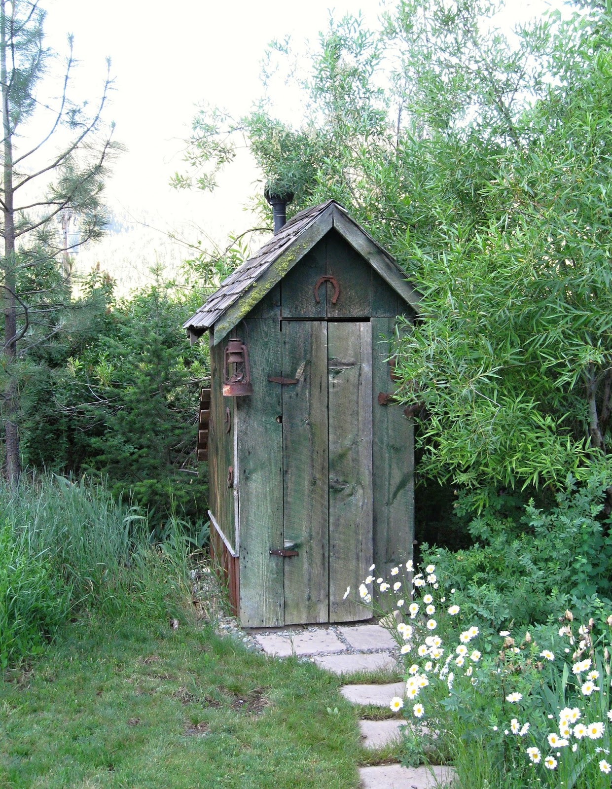 |
| The Bike Barn's outhouse which inside is like an airplane's toilet |
Day 3 6 June 2016
Bike Barn (about 6 miles West of Winthrop) to Riverside Washington
79.4 miles, 9:32 riding time, 3,507 ft elevation gain
We did have about 2/3's of the daily ration of oatmeal left, so we had that for our breakfast, and were off having enjoyed our too brief stay at the Bike Barn. In Winthrop hot cinnamon rolls were coming out of the oven, so we waited a few minutes for them to cool before they'd be served to us.
 |
| Hot chocolate and cinnamon roll in Winthrop - not quite as good as Linda Vrieze's homemade but still a treat |
 |
| We rode with Kathy and Roger most of the way up Loup Loup Pass |
 |
| Great guy delivery the water bottle I left in his business! |
The guy who delivered my water bottle was a former bicyclist and recommended a different route than A/C's on up to Riverside. When we arrived in Margee's RV park we paid and saw nothing open but hot dry sunny spots that were nearly grassless. Then we noticed an RV with bicycles everywhere. We headed over there and were warmly greeted, fed an iced banana/berry recovery drink, and quickly made ourselves at home with the 4 guys riding the Northern Tier supported and the SAG driver. We soon called them the supported 4.
 |
| Our friends "The Supported Four" Rick, Sue (SAG driver), Bob, Jim, and Bruce |
Day 4 7 June 2016
Riverside, WA to Republic, WA
60.7 miles, 6:43 riding time, 4,307 elevation gain
The A/C route to this point has been great, but when WA 20 turns east in Tonasket, industrial traffic picks up as the shoulder disappears, and the route is unpleasant for 20 miles or so. The hill out of town is steep, and there we found Rick fixing his flat- a rare occurrence with good touring tires which Rick had in the RV but hadn't put on his bike yet!
 |
| Rick fixing his flat in the hot summer sun! |
 |
| Steve, Rick, and Christy at the top of Waconda Summit |
Rick and I rode together after his flat. Christy and I were treated like part of the Supported 4's group as we climbed Wauconda Pass. The SAG was there every few miles with water. Waconda has nothing in it except a part time post office, so we had our PB&J sandwiches there and climbed on to the top. Down the grade to Republic where finally Christy's appetite seemed to be picking up as we had a post ride snack before heading out to Gold Mountain RV Park where we set up our tents with the Supported 4 and had dinner with them. Bob's a bit of a chef, so they're eating well on their ride across America, and we enjoyed pasta with some Italian sausage and a great salad. I think I'd suffered a severe calories deficient day 2 and 3, and caught up here as they kept passing the pasta, saying they didn't want any left, as I kept taking another helping!
Day 5 8 June 2016
Republic, Washington to the Bacon Bike Hostel about 4 miles E of Colville, WA
61.3 riding miles, 7:18 Riding Time, 4,688 ft elevation gain
Yesterdaly's climb up Waconda Pass was tough, so the Supported 4 decided to SAG to the top of Sherman Pass, Washington's highest, and ride down the other side, so we said our good-byes to a group we really enjoyed. The heat spell had broken overnight and the day was cloudy and cool unlike the earlier days. On the climb up to Sherman we had a few brief spells of big rain drops and a couple claps of thunder.
 |
| Christy and Steve near the top of Sherman Pass |
 |
| Steve and Christy at the top of Sherman Pass- rain gear on prepared for what is coming |
The back roads to Colville are another excellent choice of Adventure Cycling. We bought groceries (somehow forgetting peanut butter!) and headed on out to the Bacon Bike Hostel, a highlight of the trip we'd been looking forward to since we started early planning of the trip. A couple has fixed up a 3 bedroom 2 bath apartment for use by x-country cycling tourists and have done a great job. They even welcomed us for a layover day. We planned the layover day long ago, but after Rainy, Washington, Waconda, and Sherman Passes we both thought we needed it.
 |
| The bike loaded with gear and groceries - just how Tom Germano taught me to load groceries? |
Day 6 9 June 2016
Layover day Bacon Bike Hostel 4 miles East of Colville, Wa
0 miles
What a great place for a layover day. Christy (as well as Sean and Carol whom we hope to catch by Saturday, 11 Jun) long ago agreed to do Yoga with me weekly. I'm sure Christy felt like she'd rather lie around on the couches, but she was up at 0500, and we started yoga shorty thereafter. My aging stiff body benefits greatly from it, so I want to continue on tour, and even Christy has an occasional ache and pain on this trip.
 |
| Christy in Warrior 1 |
 |
| Christy- spending much of the day catching up on her blog |
We were delighted that cousin Josh Millard looked us up and came out to the Bacon Bike Hostel and delivered that jar of needed peanut butter (it's quite a hill back to town).
 |
| Cousin Josh Millard with Steve at the Bacon Bike Hostel. He also delivered the peanut butter we had forgotten to buy yesterday |
 |
| 2nd night's dinner at the Bacon Bike Hostel - good living- dinner on real plates with stainless ware to boot! |
Day 7 10 June 2016
Bacon Bike Hostel 4 miles E of Colville, WA to Panhandle USFS Park near Oldtown, Idaho
55.2 mile, 5:14 riding time, 2,162 ft elevation gain
First light of dawn usually gets us up, but this morning it was the sound of rain on the nearby metal roofs which stole some of our motivation, so we had a slow breakfast and cleaned up the Bike Hostel leaving about 9:45. Light rain continued throughout the morning pushing us toward an inside lunch at the Beaver Resort which our 4 supported friends had just left that morning.
 |
| Steve in his rain jacket at Crystal Falls |
Day 8 11 June 2016
Panhandle Campgrounds to Sandpoint, Idaho
70.7 miles, 6:54 riding time, 2,139 ft elevation gain
Up at the crack of dawn again and pleased that the rain hadn't returned we left earlier than we thought necessary so we'd meet the rest of our group in Newport, WA at 11:00. Instead of the usual west winds, we were fighting a South wind as we headed directly south. We crossed the river to Usk to enjoy a fresh doughnut.
 |
| Christy on the road between Panhandle Campground and Oldtown, Idaho |
 |
| View from the bridge going into Usk, Washington |
 |
| Reunited and it feels so Good.. Steve, Christy, Carol, and Sean at their lunch stop |
 |
| Carol in her rain gear at the end of portion 1 of the storm |
 |
| On old hwy 95 bridge (now a run-down bikep path) going into Sandpoint: Sean, Carol, and Christy |
Bruce, a friend and former co-worker of Sean's had invited us to stay in his parent's summer home with him that night, so we bought the pizza. Even with good company, we're in bed shorty after the sun sets. Bruce had a toasty fire going by which we dried our clothes. Bruce is also a professional bike mechanic and spent some time adjusting our bikes. My bikes' brakes were nearly worn out from the wet descent of Sherman Pass, and I'm enjoying their working again! Thanks for everything Bruce!
 |
| Bruce beside his stove which is drying our wet clothes on the clothes rack |
Sandpoint, Idaho to Two Rivers RV Park near Noxon, MT
48.4 miles, 4:18 riding time, 1,529 ft elevation grain
Up early again for a breakfast of eggs, bacon, and steel cut oats. A fog bank seemed to be hanging over the eastern edge of town, but by the time we left Safeway, it was gone. Blue skies, a mild tail wind, and smooth pavement characterized most of the day's riding. We chose the alternate route to avoid Hwy 20 in Montana which put us on some gravel roads after our lunch in Clark Fork where we again met with Gary whom Christy and I had met briefly as we passed him on our way up Sherman Pass.
 |
| Gary riding helmetless back to Wisconsin |
 |
| view going into Montana where the alternate route turns to gravel |
We arrived in camp somewhat fresh after only 48 miles with a tailwind, so Gary left us headed for the next campground about 20 miles farther up the road. We had time for laundry.
 |
| Laundry day, clothes hung in camp as we all get on the same laundry schedule |
Day 10 13 June 2016
Two Rivers RV Park near Noxon, MT to Woodland RV Park, Libby MT
51.1 miles, 4:33 riding time, 1,844 elevation gain
The original schedule had us going to Libby today, but we thought we might add another 20 miles and go to a rural campground outside of town if everyone was feeling strong. Temps were low and it was cloudy as we left the RV park, but within a couple of hours we were in jerseys and shorts.
 |
| Sean chowing down on a PB&J sandwich, our standard lunch fare |
 |
| Christy, Carol, & Sean bellied up for ice cream at the afternoon snack |
 |
| Christy and Carol at Kootenai Falls- look to them for cycling adventures but not to get too close to cliffs or fast moving water |
 |
| Kootenai Falls, Montana |
As we entered Libby, Sean spotted a Radio Shack and asked if I wanted to continue my search for my camera's CR2120 battery. I reluctantly went in while they cycled down to the RV park. The clerk said they didn't carry it, but after I whined about the whole unpleasant experience of searching for the battery, she went looking thru their stock, and found one! That hassle should be over. Who's happier about that me, or my co-travelers? Then I found a do-it-yourself car wash where the remains of my brakes could we washed off my bike's wheels. I'm still enjoying the adjustments Bruce made to my bike back in Sandpoint, and I'm a happy camper as I write this!
 |
| Carol enjoys her hammock before dinner |
Day 11 14 June 2016
Woodland Park RV Park, Libby MT to Eureka, MT
69.8 miles, riding time, elevation gain
I awoke to rain on the tent at dawn this morning, but my fellow travelers told me I'd slept through some rain during the night. Sleeping has been good! The rain stopped by the time we left Libby as we headed out an old seldom driven highway.
 |
| Roads like this characterized most of the morning. Ed Weston on the 3 wheeled recumbent |
A harder rain than what had awoken me this morning soon forced us to take shelter under trees, and everyone else dawned their rain gear. Rain remained intermittent all day, and the gals suffered from wearing too many rain clothes. Last night we had decided to continue on the alternate route that would have us on roads as quiet as on the morning's ride, but at the diversion point Carol decided to save a few miles we'd stay on the main highway which was quiet and rolling above the reservoir behind Libby Dam. Ed and Zig did the route we'd planned. The passing rains changed the wind's direction frequently, but for the most part we had strong tailwinds. So, when we arrived at Rexford, the planned destination for the day, the group decided to push for an almost 70 mile day. We'd had only a hotdog sort of thing for lunch and were hungry and tired when we arrived on the edge of Eureka, and a group of 3 mountain bikers doing the Great Divide Route and staying in a motel called out to us. I'm not sure why Sean got us a motel there. We ate out and we met lots of Great Divide Mountain Bike racers (we were there with the tail end of the racers), and we got to know road tourists Ed and Zig better (Ed's blog). Internet for some reason didn't work in the motel rooms, but the Subway Sand shop which was part of the same complex was owned by the same people and we were welcomed in there without spending any more money. Four loaded bikes and four people in a room seems too crowded to me, so I was happy to spend the free evening hour or two in the Subway blogging and emailing..
 |
| Christy & Carol at Libby Dam |
 |
| Sean removes a link from Carol's chain hoping it will improve her shifting out of the lower gears |
 |
| Zig Zelmer and Ed West in the Subway. Zig's bike has some frail carbon fiber part that broke. They'll be laid over for a while. Ed rides a 3 wheeled trike seen in earlier photo |
Day 12 15 Jun 2016
Eureka, MT to Bike Retreat 6 miles E of Whitefish, MT
57.7 miles, riding time, 2,585 ft elevation gain
Ed joined us for a restaurant breakfast. Then off to a good grocery store in Eureka for supplies for the day and night. Great back roads again although some were steep. Then about morning snack time a great surprise in Fortine, Montana- a pie shop!
 |
| Christy enjoys huckleberry cheese cake in Fortine, MT I had a piece of this too! |
Carol and Sean surprised me with the idea that we skip the planned ride into Canada after going over Going to the Sun Highway. I was concerned that the motivation was to take "the shortest, fastest, easiest route" across the country and would set the tone for further changes, but I was out voted and this first change in the plan didn't matter than much to me. It rained that night soaking the towels everyone had left out to dry after our evening shower.
 |
| Dinner prep at the Bike Retreat: Christy, Carol, and Sean |
 |
| Breakfast Prep in the rain at the Bike Retreat near Whitefish, MT Sean supervising Christy cooking |
Day 13 16 Jun 2016
Bike Retreat near Whitefish, MT to Sprague Campground Glacier NP
63.0 miles, riding time: 6:23
Suddenly this morning Carol presented the idea of skipping the highlight of the entire ride, Going to the Sun Highway, and taking the shorter, faster, easier and far less interesting highway over Maria's Pass. So, the idea of not going into Canada was now extended to skipping "Going the Sun". This second and major change in our plans did matter to me. Carol again took the free shuttle into Whitefish to Glacier Cyclery while the rest of us rode into town. As we met at the bike shop Sean announced that the East side of Going to the Sun Highway had been closed. We went into Glacier Cyclery where nothing I head in the conversation will match what Sean would report, but here's what I heard. The employee is a dedicated cyclist who rides Going to the Sun regularly. He said we'd arrived at the best possible time, the road was opened to cyclists and closed to motorists while work was finished on the side railings which as usual were damaged by the winter's snowfall. He'd been riding it for 3 weeks which at first was thru some snow at the very top, but that the snow had been gone for the last 2 weeks, and he's rented bikes even the day before we were there to people who'd had a great ride (and caught the train back). He catches the train back to Whitefish after most of his rides over the top and verbally gave us its schedule. Riding the train was an easy option for anyone not wanting to ride over Going to the Sun, and he suggested Carol do that or take a shuttle over the pass, but she wasn't interested in being temporarily solo. He also mentioned an "all you can eat" breakfast buffet a mile from Sprague Campground where we had planned to stay. Sean asked if snowfall were possible, and he said snow is always possible at the top. Another employee also said how lucky we were in our timing with the road plowed and opened only to cyclists. Both said the traffic was pretty heavy on US 2 (Maria's Pass) and the shoulders were sometimes good and sometimes not there. Sean reported all this as reasons not to ride Going to the Sun. The shop employees also pulled up a weather report that showed winds at the top of 20MPH on 17 Jun which seemed to sway Christy. No matter what the others did, I wasn't changing my plans to exclude Going to the Sun Highway.
We needed to wash clothes, so off to the laundry where the decision was solidified. Sean is quite adapt at finding stuff with his GPS which he appears to have mastered (he's teaching Christy who will soon catch up with his skills, I believe). My last question before the group left me for their side trip (of two layover days and the easy Maria's Pass) was "here at the laundromat we're still on route, right?" The correct answer would have been "no, we're about 1/2 mile beyond a turn, so reverse course", but they answered "yes". About 1 mile down the road, I had my first flat:
 |
| My bike in its undignified position as the glue on the tube dries in preparation for the patch |
 |
| Black clouds lie ahead as I reach the end of the pavement on more great back roads |
 |
| Lake McDonald near Sprague Campground where I'd stay |
I arrived at the right time to miss the "no bicycling hours" up to Sprague Campground. I set up camp and headed up to the lodge a mile away. I no more than sat down in the restaurant, and the downpour started again. It lasted over an hour and went back to a drizzle just as I was ready for the ride back to camp. The neighbors invited me over for their supper of ribs and to enjoy their campfire, so I stayed up until after nightfall talking and enjoying their company.
 |
| The neighbors from Waterford, SD who invited me to share in their rib dinner and campfire |
Day 14 17 Jun 2016
Glacier Park- Going to the Sun- Jewel in the Crown of the Northern Tier
47 miles, riding time 5:47
This was scheduled as a rest day, but the reports of the weather forecast I was hearing second-hand said it would be a perfect day for the ride and rain might return the next day. The only bad news was the ranger's coming by to confirm that the road had just opened to motorized traffic. I rode back to the "all you can eat breakfast buffet" where I did eat a bit too much. That "too full" feeling had passed by the time the grade began to steepen.
 |
| View just before leaving the shores of Lake McDonald |
 |
| starting the climb |
 |
| Steve on the climb |
 |
| Looking back down the road |
 |
| The kids in this family couldn't stop staring at me- dressed in skin tight clothing in the colors of a canary (great for cycling but not so good for public display on my body away from the bike), so I started talking to them. Lots of questions- one at a time never interrupting each other or me. Impressive family, so I asked to photograph them. |
 |
| Steve nearing the top |
 |
| At the top! |
 |
| A view from the much less spectacular East Side |
 |
| Chris finishing up his breakfast just before we parted |
Continued as Northern Tier - Phase II - The Great Plains, Land of Shifting WInds
Same story different perspective Christy's blog
Happy Cycling for Fun, Fitness, and Transportation!
Steve
No comments:
Post a Comment